Fig. 3
Download original image
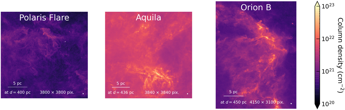
Three examples of H2 column density maps from the HGBS. The spatial resolution of the maps is 18″, sampled with a pixel size of 3″. As a reference, a white dot with diameter 90″ (which amounts to five times the resolution) is shown at the bottom right corner of each map. Estimates of spatial scales, also shown on the maps, are based on reported distances (see Table 1). The Polaris Flare is an example of a diffuse and quiescent cloud, while Aquila and Orion B are dense and very active star-forming regions.
Current usage metrics show cumulative count of Article Views (full-text article views including HTML views, PDF and ePub downloads, according to the available data) and Abstracts Views on Vision4Press platform.
Data correspond to usage on the plateform after 2015. The current usage metrics is available 48-96 hours after online publication and is updated daily on week days.
Initial download of the metrics may take a while.