Fig. 3.
Download original image
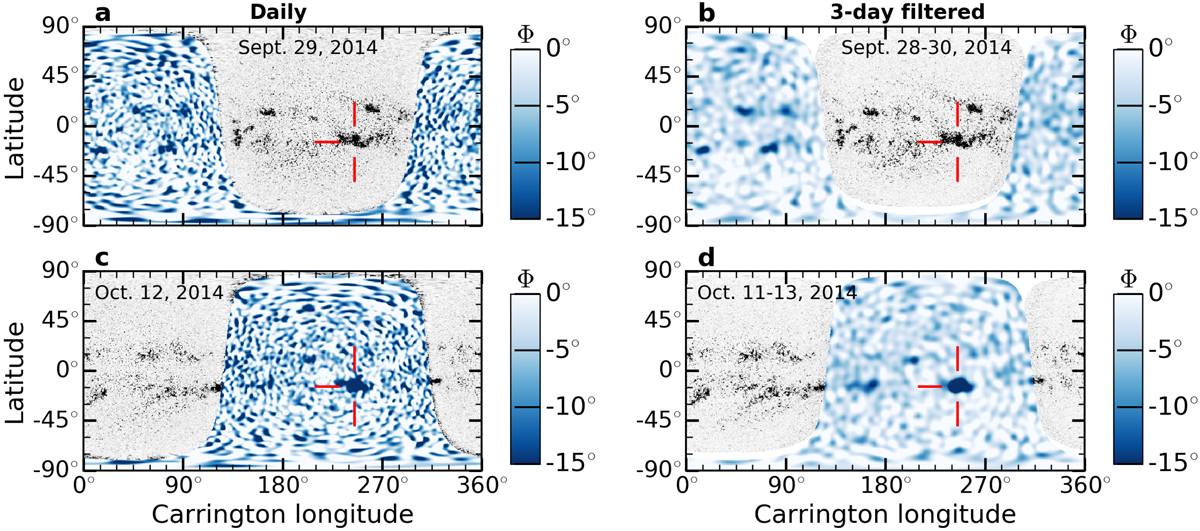
Composite maps showing the very large active region NOAA 12192. Shown are composite maps, but for different Carrington rotations. STEREO observations are not available for comparison. Panels a,b: seismic map for September 29, 2014 (constructed as Fig. 2a) and the average over September 28–30 (constructed as Fig. 2b). The longitude is that of Carrington rotation 2155. Panels c,d: same as above, but 13 days later. Active region NOAA is very clearly seen on both the near and far sides.
Current usage metrics show cumulative count of Article Views (full-text article views including HTML views, PDF and ePub downloads, according to the available data) and Abstracts Views on Vision4Press platform.
Data correspond to usage on the plateform after 2015. The current usage metrics is available 48-96 hours after online publication and is updated daily on week days.
Initial download of the metrics may take a while.