Fig. 1
Download original image
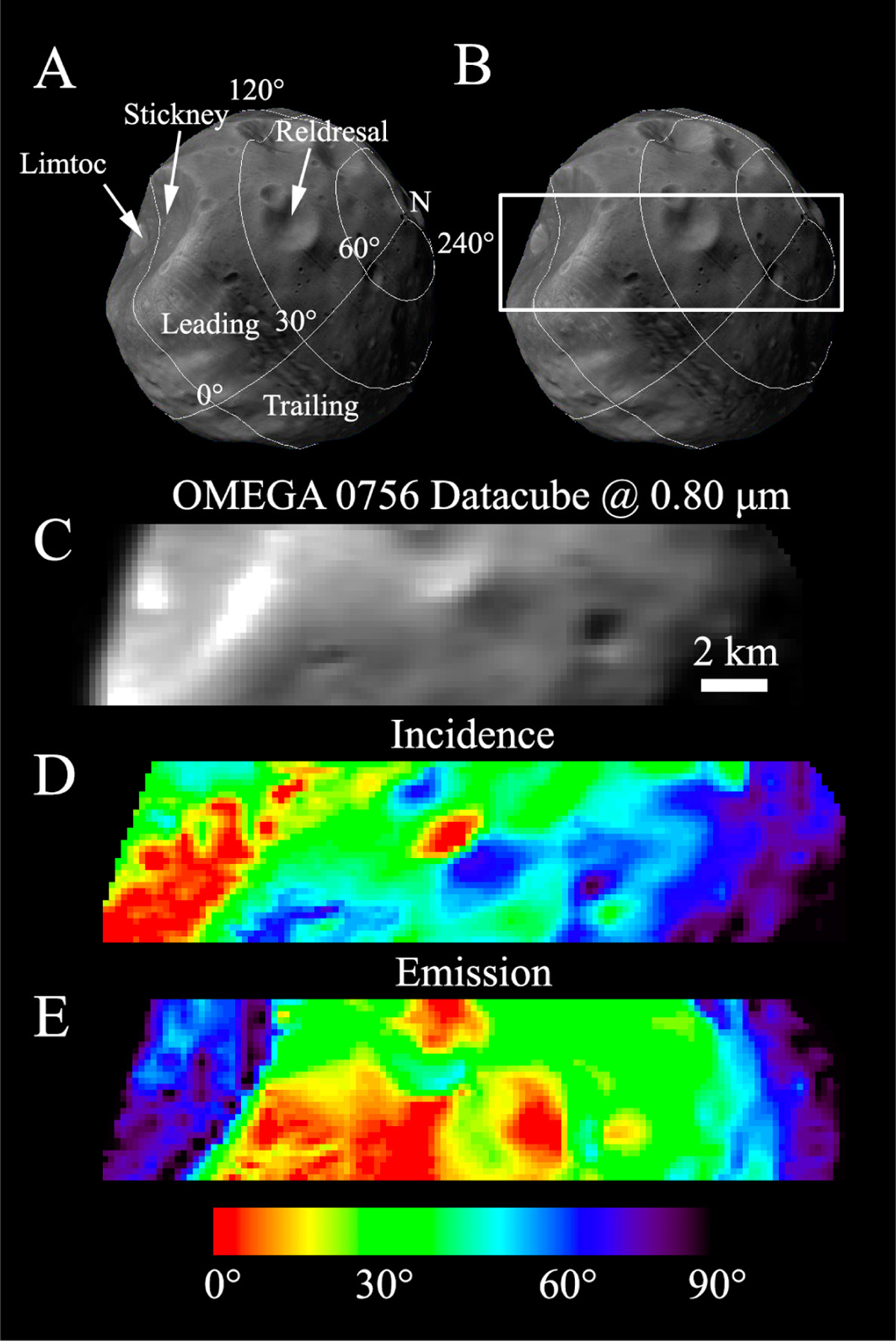
(A) Latitude and longitude map of Phobos reoriented as the OMEGA 0756 datacube. The Stickney, Limtoc, and Reldresal craters are indicated with white arrows. (B) Area of Phobos observed by OMEGA. (C) Original OMEGA dataset at 0.80 μm (not yet Lommel-Seeliger corrected; see Section 3.2). (D) Incidence map. (E) Emission map produced through the use of the Phobos shape model (Willner et al. 2010) and the ancillary information of the spice kernels.
Current usage metrics show cumulative count of Article Views (full-text article views including HTML views, PDF and ePub downloads, according to the available data) and Abstracts Views on Vision4Press platform.
Data correspond to usage on the plateform after 2015. The current usage metrics is available 48-96 hours after online publication and is updated daily on week days.
Initial download of the metrics may take a while.