Fig. 1
Download original image
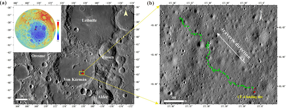
Geologic context of CE-4 landing region and distribution of spectral detection sites. (a) Landing site of CE-4 (red flag). The basemap is from the Lunar Reconnaissance Orbiter Camera (LROC) Wide Angle Camera. The inset in the upper left corner is a digital elevation model; (b) VNIR measurement sites (green dots) along the Yutu-2 rover’s travel path. The Yutu-2 rover has been travelling in the northwest direction from the landing site. The basemap is from the LROC Narrow Angle Camera image.
Current usage metrics show cumulative count of Article Views (full-text article views including HTML views, PDF and ePub downloads, according to the available data) and Abstracts Views on Vision4Press platform.
Data correspond to usage on the plateform after 2015. The current usage metrics is available 48-96 hours after online publication and is updated daily on week days.
Initial download of the metrics may take a while.