Fig. 5
Download original image
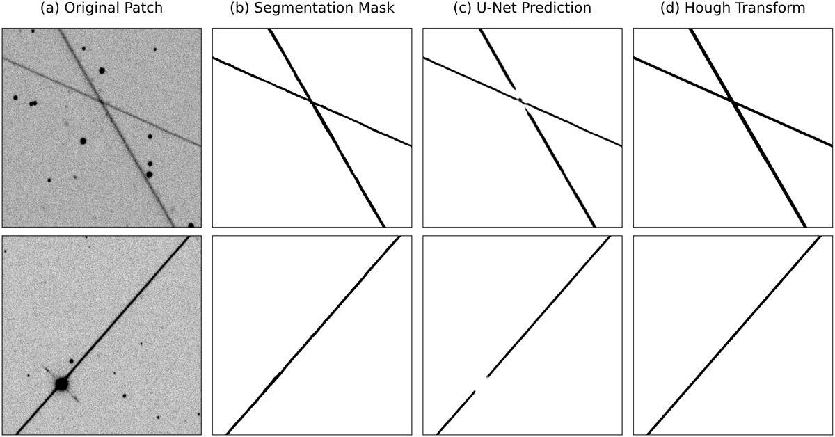
Sequential steps of satellite trail detection and refinement: (a) Original patch image, (b) Ground truth segmentation mask, (c) U-Net predicted segmentation map, (d) Final result after applying the probabilistic Hough transform. This workflow demonstrates the process from initial detection to refined trail delineation, ensuring precise identification and continuity of satellite trails.
Current usage metrics show cumulative count of Article Views (full-text article views including HTML views, PDF and ePub downloads, according to the available data) and Abstracts Views on Vision4Press platform.
Data correspond to usage on the plateform after 2015. The current usage metrics is available 48-96 hours after online publication and is updated daily on week days.
Initial download of the metrics may take a while.