Fig. A.5
Download original image
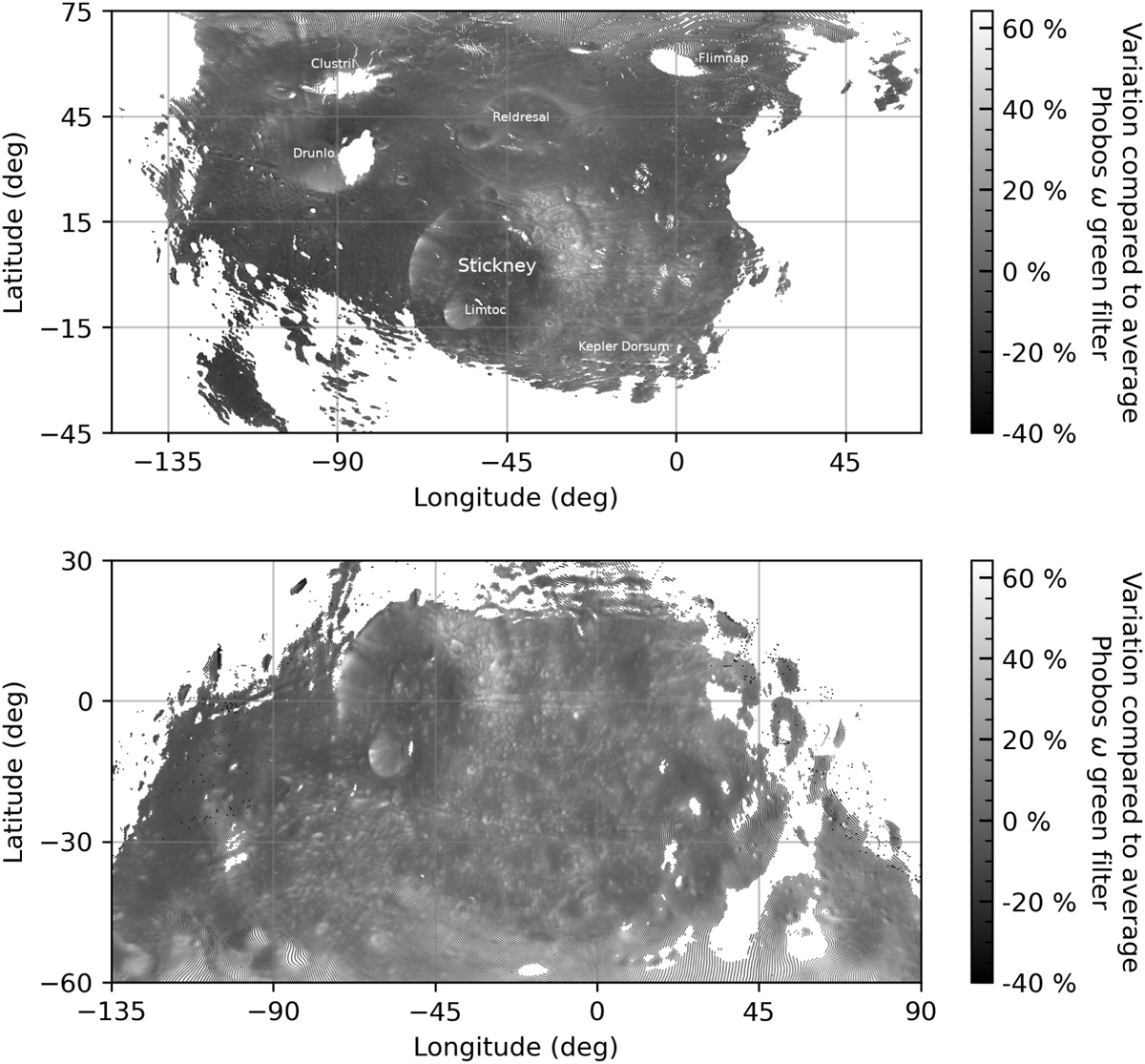
Maps generated from SRC images: Relative variation of the albedo compared to the average value (7.1%) determined with the green filter and used to normalize the SRC data. Top: From the image 2019-11-17T03:27:01 acquired during K076 orbit. Bottom: From the image 2020-09-26T02:18:40 acquired during L155 orbit. The gray color scale permits better visualization of the albedo-geomorphological feature correlation compared to the colored map presented in Fig. 9.
Current usage metrics show cumulative count of Article Views (full-text article views including HTML views, PDF and ePub downloads, according to the available data) and Abstracts Views on Vision4Press platform.
Data correspond to usage on the plateform after 2015. The current usage metrics is available 48-96 hours after online publication and is updated daily on week days.
Initial download of the metrics may take a while.