Fig. 3
Download original image
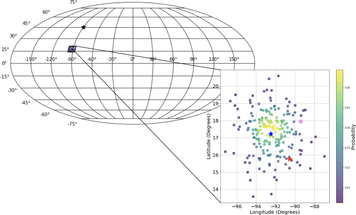
Plane of the sky projections of the UHECR arrival directions as inferred given local and sparse GMF data based on 100 posterior samples (viridis colormap). The GMF reconstruction problem is the one shown in Fig. 1. The red star denotes the true arrival direction, while the black star denotes the observed arrival direction, and they are found 1.6σ and 22.8σ from the posterior’s mean, respectively. For comparison, we also inferred the UHECR arrival direction using a simple vector mean of all the GMF data points (blue star), as well as a a nearest-neighbor estimate (pink star), where at each point the GMF was assumed to be that dictated by the nearest available data point. These simple reconstruction methods do not provide an uncertainty quantification. In addition, they tacitly assume either a low λ, or data points that are populated densely enough – something that cannot be expected from the distribution of dust clouds in real life applications.
Current usage metrics show cumulative count of Article Views (full-text article views including HTML views, PDF and ePub downloads, according to the available data) and Abstracts Views on Vision4Press platform.
Data correspond to usage on the plateform after 2015. The current usage metrics is available 48-96 hours after online publication and is updated daily on week days.
Initial download of the metrics may take a while.