Fig. 9
Download original image
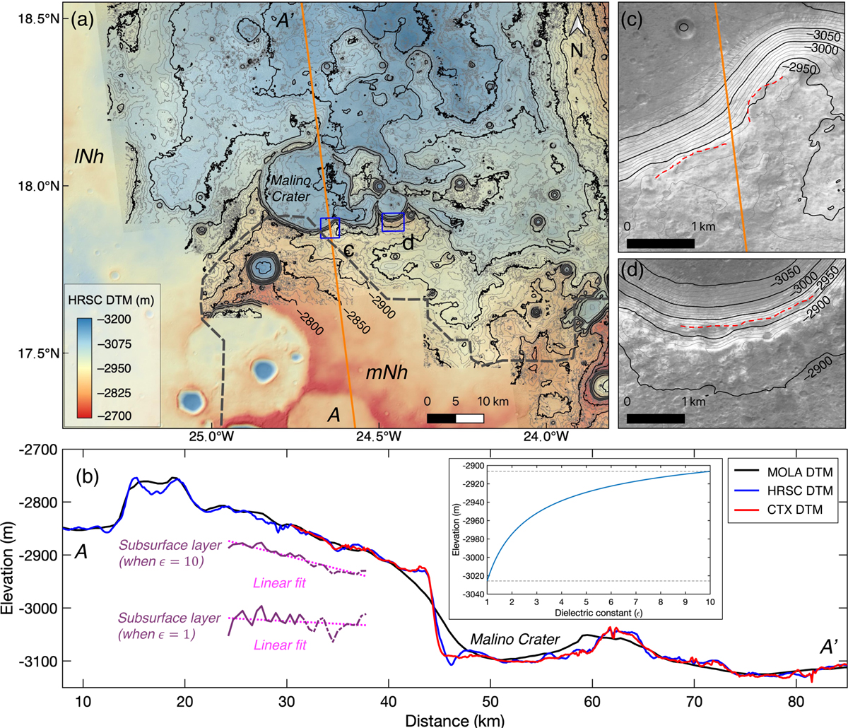
Surface imagery showing exposed layers at the crater rim. (a) Base map of the CTX mosaic image overlaid by the hill-shaded HRSC DTM and contour lines of the CTX DTM. The orange line shows the footprint of the radargram of 05594002 in this region, (b) Elevation profiles along AA’ of the radargram. The possible subsurface layer is delineated as the purple solid lines with the magenta dotted line showing the linear fit of them, respectively, (c) Close-up view of the southern rim of the Malino Crater and (d) a close-up view of the southern rim of one smaller crater with contour lines in black and dashed lines with red showing the exposed layers.
Current usage metrics show cumulative count of Article Views (full-text article views including HTML views, PDF and ePub downloads, according to the available data) and Abstracts Views on Vision4Press platform.
Data correspond to usage on the plateform after 2015. The current usage metrics is available 48-96 hours after online publication and is updated daily on week days.
Initial download of the metrics may take a while.