Fig. 4
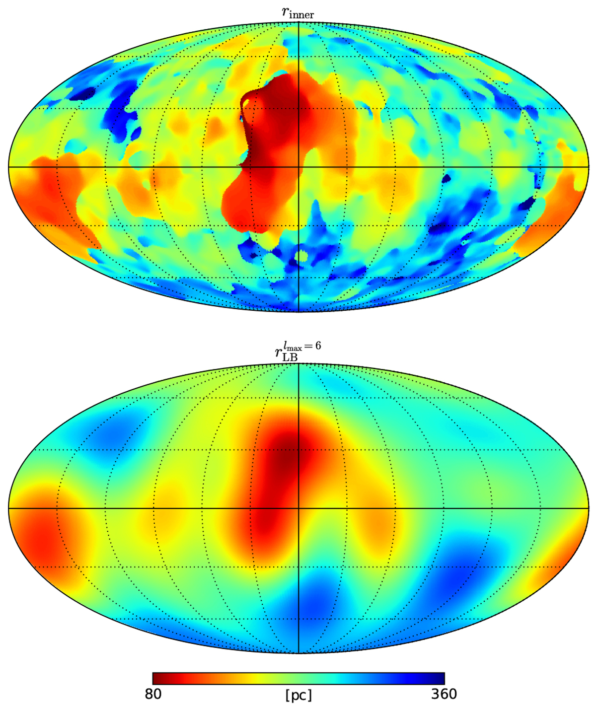
Full-sky map of (top) the inner surface of the LB shell (rinner) as extracted from the L19 3D extinction map (Sect. 2.2.1) and (bottom) our model of this surface through a spherical harmonic expansion up to lmax = 6 (Sect. 2.2.2). The maps are in Galactic coordinates, the center points towards the Galactic center and longitude increases to the left.
Current usage metrics show cumulative count of Article Views (full-text article views including HTML views, PDF and ePub downloads, according to the available data) and Abstracts Views on Vision4Press platform.
Data correspond to usage on the plateform after 2015. The current usage metrics is available 48-96 hours after online publication and is updated daily on week days.
Initial download of the metrics may take a while.