Fig. 9.
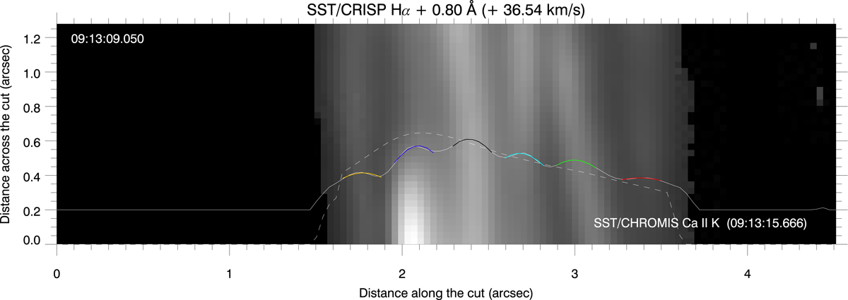
Hα slice corresponding to path 1 at the same time and wavelength position as the right-most panel of Fig. 8. Six rain strands are clearly visible with widths of about 0.2″ (i.e. 140 km). The black area corresponds to locations where no rain blobs are detected (under the intensity threshold). The white solid line corresponds to the average intensity (arbitrary units) along the path for the slice. The different coloured lines are the widths of the spatial Gaussian fits to the different blobs. The white dashed lines corresponds to the average intensity for the same slice at the closest time and Doppler shift in Ca II K line.
Current usage metrics show cumulative count of Article Views (full-text article views including HTML views, PDF and ePub downloads, according to the available data) and Abstracts Views on Vision4Press platform.
Data correspond to usage on the plateform after 2015. The current usage metrics is available 48-96 hours after online publication and is updated daily on week days.
Initial download of the metrics may take a while.