Fig. A.2
Download original image
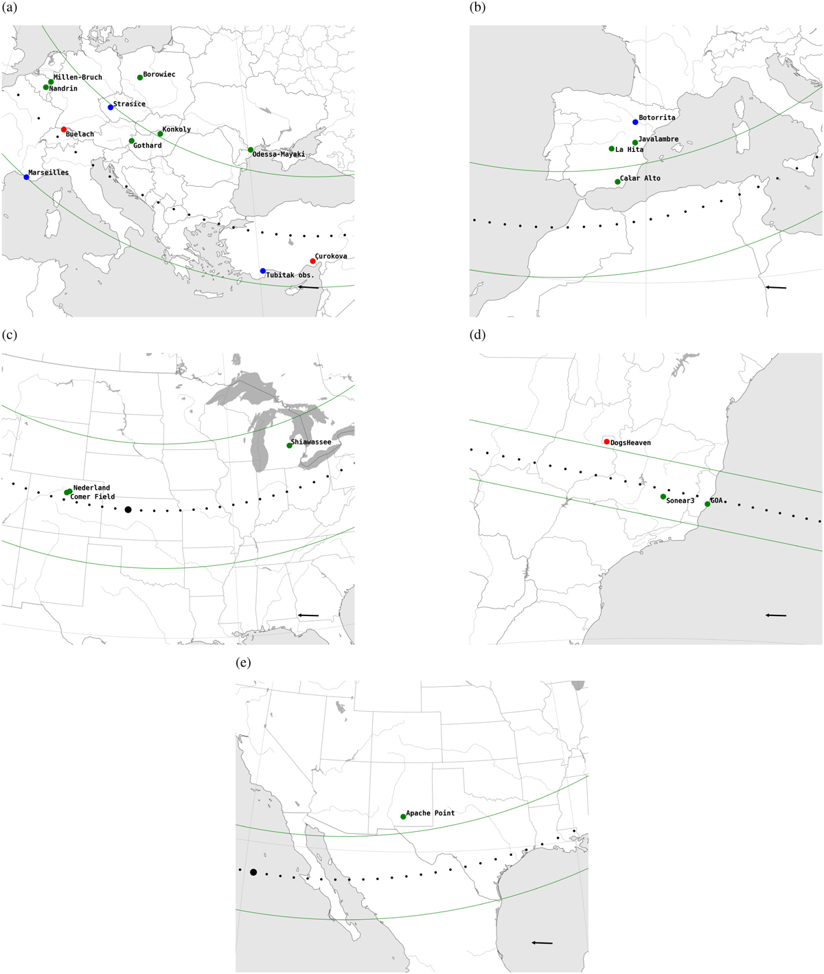
Predicted occultation shadow path computed from JPL#18 ephemerids for (a) May 26, 2020, (b) June 23, 2022, (c) May 17, 2023, (d) May 19, 2023, and (e) July 01, 2023. The green lines depict the boundaries of the shadow path assuming a 455 km diameter body. The black points indicate the center of the shadow path at 5-second intervals, with the largest point representing the central moment of the prediction. The dots indicate the positions of the stations involved in the campaigns. Green dots signify sites where a positive occultation was observed, red dots a negative occultation, and blue ones indicate low S/N or technical issues (neither positive nor negative). These maps have been generated using SORA. The bottom right arrows denote the shadow’s direction of motion.
Current usage metrics show cumulative count of Article Views (full-text article views including HTML views, PDF and ePub downloads, according to the available data) and Abstracts Views on Vision4Press platform.
Data correspond to usage on the plateform after 2015. The current usage metrics is available 48-96 hours after online publication and is updated daily on week days.
Initial download of the metrics may take a while.