Fig. 1
Download original image
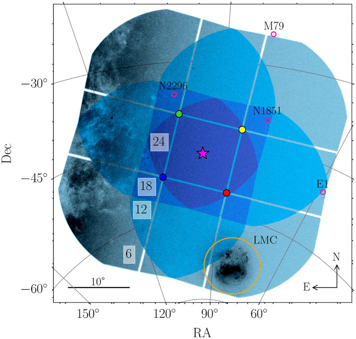
Illustration of the first PLATO pointing field called LOPS2. The platform pointing (being parallel to the pointing of the two F- CAMs; see magenta star) is centred at the equatorial coordinate (α, δ) = (95.310 43°, −47.886 93°), with zero rotation with respect to the Galactic equator. The N-CAM overlap of nCAM ∈ {6,12,18,24} is illustrated with an increasing darker shade of blue (also indicated in the white boxes), and the blue, green, yellow, and red dot show the pointing of N-CAM group one, two, three, and four, respectively. The black transparent map highlights dense sky regions such as the location of the Milky Way plane, the Large Magellanic Cloud (LMC, encircled in orange), and a few globular clusters (pink circles, from Harris 1996).
Current usage metrics show cumulative count of Article Views (full-text article views including HTML views, PDF and ePub downloads, according to the available data) and Abstracts Views on Vision4Press platform.
Data correspond to usage on the plateform after 2015. The current usage metrics is available 48-96 hours after online publication and is updated daily on week days.
Initial download of the metrics may take a while.