Fig. 3.
Download original image
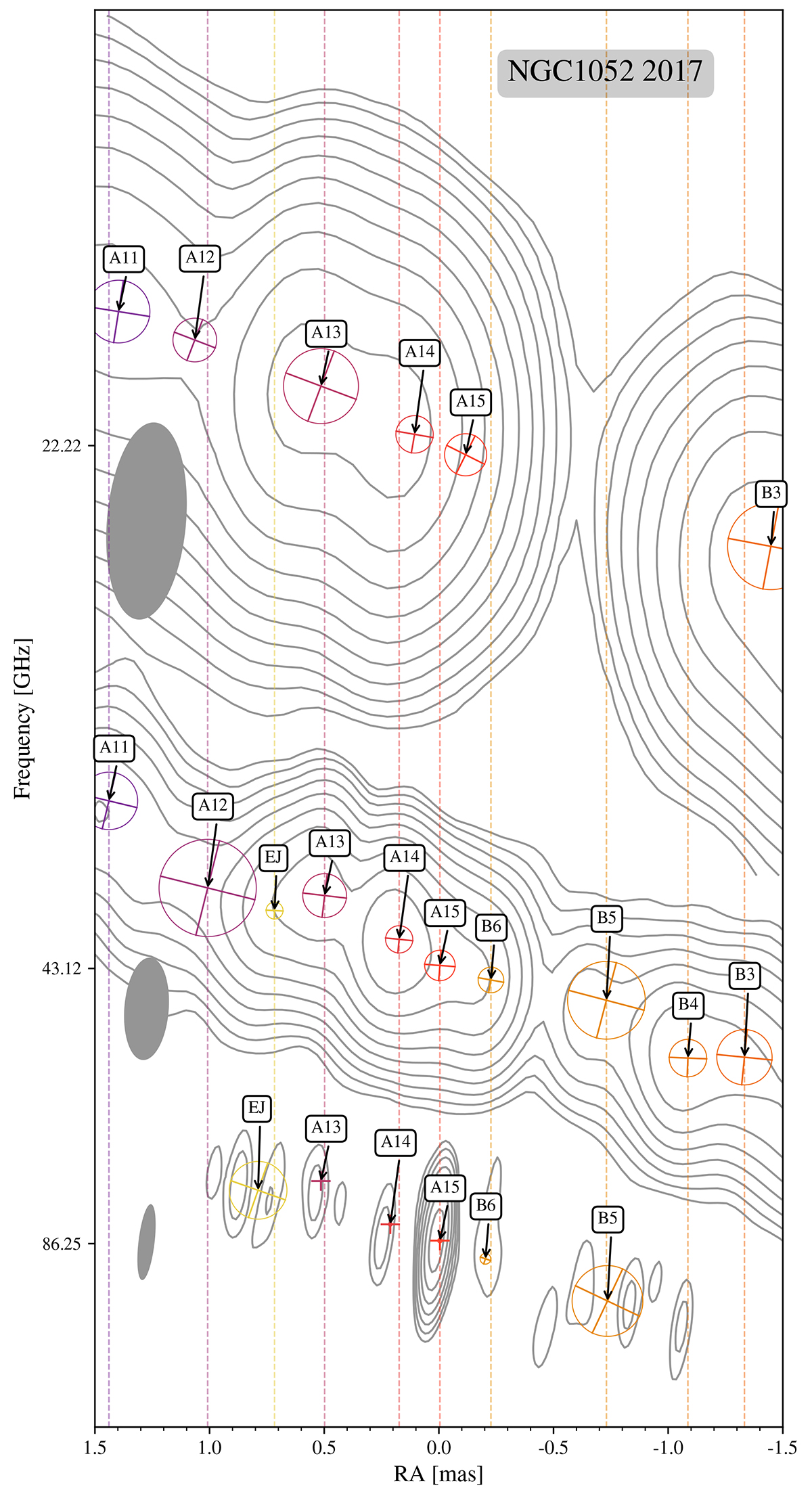
Contour maps of NGC 1052 at 22, 43, and 86 GHz with Gaussian model components plotted on top, the contours start at 3 times the noise level. The DEC scale is equal to the RA scale. The map origin is located at the map peak of the 86 GHz image. VLBA maps were shifted with respect to the 86 GHz image based on the alignment described in Baczko et al. (2022) and by identifying the 86 GHz central component with A15. The dashed lines correspond to the component positions at 43 GHz. The components have names assigned as A for the eastern jet and B for the western jet.
Current usage metrics show cumulative count of Article Views (full-text article views including HTML views, PDF and ePub downloads, according to the available data) and Abstracts Views on Vision4Press platform.
Data correspond to usage on the plateform after 2015. The current usage metrics is available 48-96 hours after online publication and is updated daily on week days.
Initial download of the metrics may take a while.