Fig. 2.
Download original image
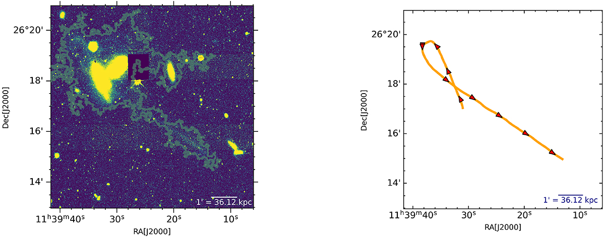
Edge map and trajectory of the tidal tail. Left panel: edge map of the faint tail detection (green contour) on the optical g-band image of the galaxy NGC 3785. The detected edge map helps define the boundary of the endpoints of the tail. Right panel: cubic spline fitting on the data points associated with the straight and looping part of the tail used to measure its length by referencing the edge map. The red arrows show the expected trajectory of the satellite galaxy.
Current usage metrics show cumulative count of Article Views (full-text article views including HTML views, PDF and ePub downloads, according to the available data) and Abstracts Views on Vision4Press platform.
Data correspond to usage on the plateform after 2015. The current usage metrics is available 48-96 hours after online publication and is updated daily on week days.
Initial download of the metrics may take a while.