Fig. 2.
Download original image
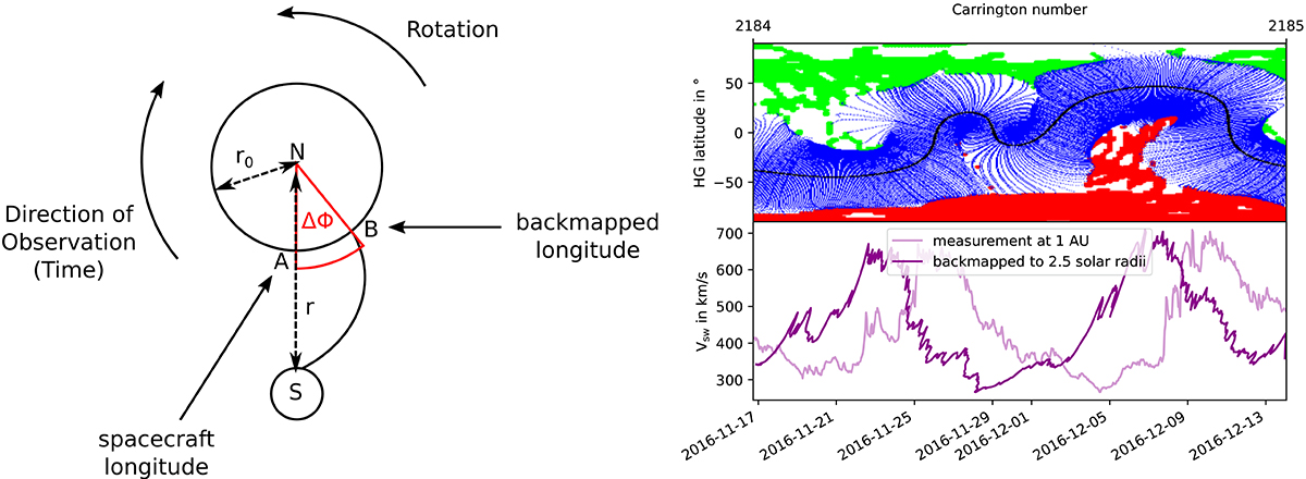
Illustration for the method of backmapping. Left: View of the sun from the north (N). The longitude of the spacecraft (S) is marked by A. When the emitted solar wind is detected by the spacecraft, the sun has continued to rotate by the angle ΔΦ leading to the backmapped longitude marked by B. Then, r and r0 are the heliocentric distance of the spacecraft and of the source surface at 2.5 solar radii, respectively. Right: GONG-map of carrington rotation 2184.0 (top; note: the map has been mirrored in order to have the time running from left to right). The in situ solar wind speed and magnetic polarity as measured at 1 AU and the backmapped data according to Eq. (1) (bottom). It is evident that the high speed streams of the backmapped data can be associated more accurately with the respective CH.
Current usage metrics show cumulative count of Article Views (full-text article views including HTML views, PDF and ePub downloads, according to the available data) and Abstracts Views on Vision4Press platform.
Data correspond to usage on the plateform after 2015. The current usage metrics is available 48-96 hours after online publication and is updated daily on week days.
Initial download of the metrics may take a while.