Fig. 1
Download original image
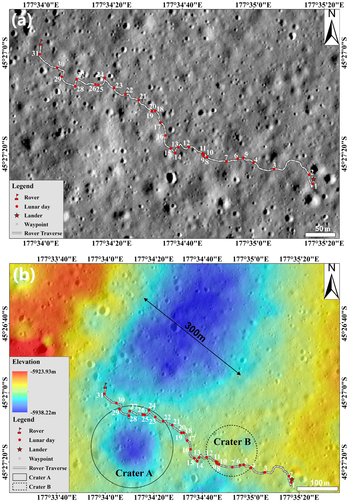
Routing path covered by the Yutu-2 rover on the Moon. (a) The base map is a Lunar Reconnaissance Orbiter (LRO) Narrow Angle Camera (NAC) image (File ID: M1314237625LR). (b) High-resolution NAC digital terrain model of CE-4 landing area. The red star marks the position of the CE-4 lander. The white line represents the traverse of the Yutu-2 rover, and the red points indicate the waypoints. The black circle outlines buried crater A, and the dashed circle shows buried crater B.
Current usage metrics show cumulative count of Article Views (full-text article views including HTML views, PDF and ePub downloads, according to the available data) and Abstracts Views on Vision4Press platform.
Data correspond to usage on the plateform after 2015. The current usage metrics is available 48-96 hours after online publication and is updated daily on week days.
Initial download of the metrics may take a while.