Fig. 8.
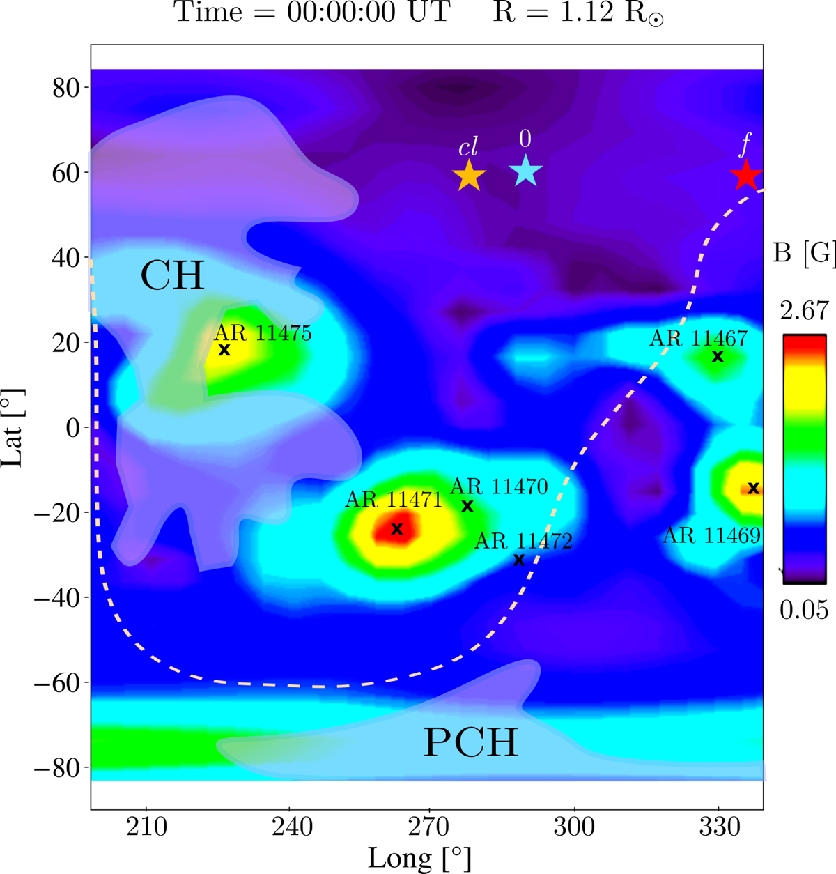
Magnetic strength map at R = 1.12 R⊙ (initial height of the prominence), from longitude 200° to 340°, on 30 April 2012 at 00:00 UT. The stars represent the initial position (cyan), the closest position to the CH (orange), and the last measured (red) prominence position. The CHs, the active regions (NOAA), and the heliospheric current sheet (WSO) are superimposed on the map. PCH stands for polar coronal hole. The map has been provided by the Community Coordinated Modeling Center at Goddard Space Flight Center through their public Runs on Request system (http://ccmc.gsfc.nasa.gov) with the PFSS model.
Current usage metrics show cumulative count of Article Views (full-text article views including HTML views, PDF and ePub downloads, according to the available data) and Abstracts Views on Vision4Press platform.
Data correspond to usage on the plateform after 2015. The current usage metrics is available 48-96 hours after online publication and is updated daily on week days.
Initial download of the metrics may take a while.