Fig. 1.
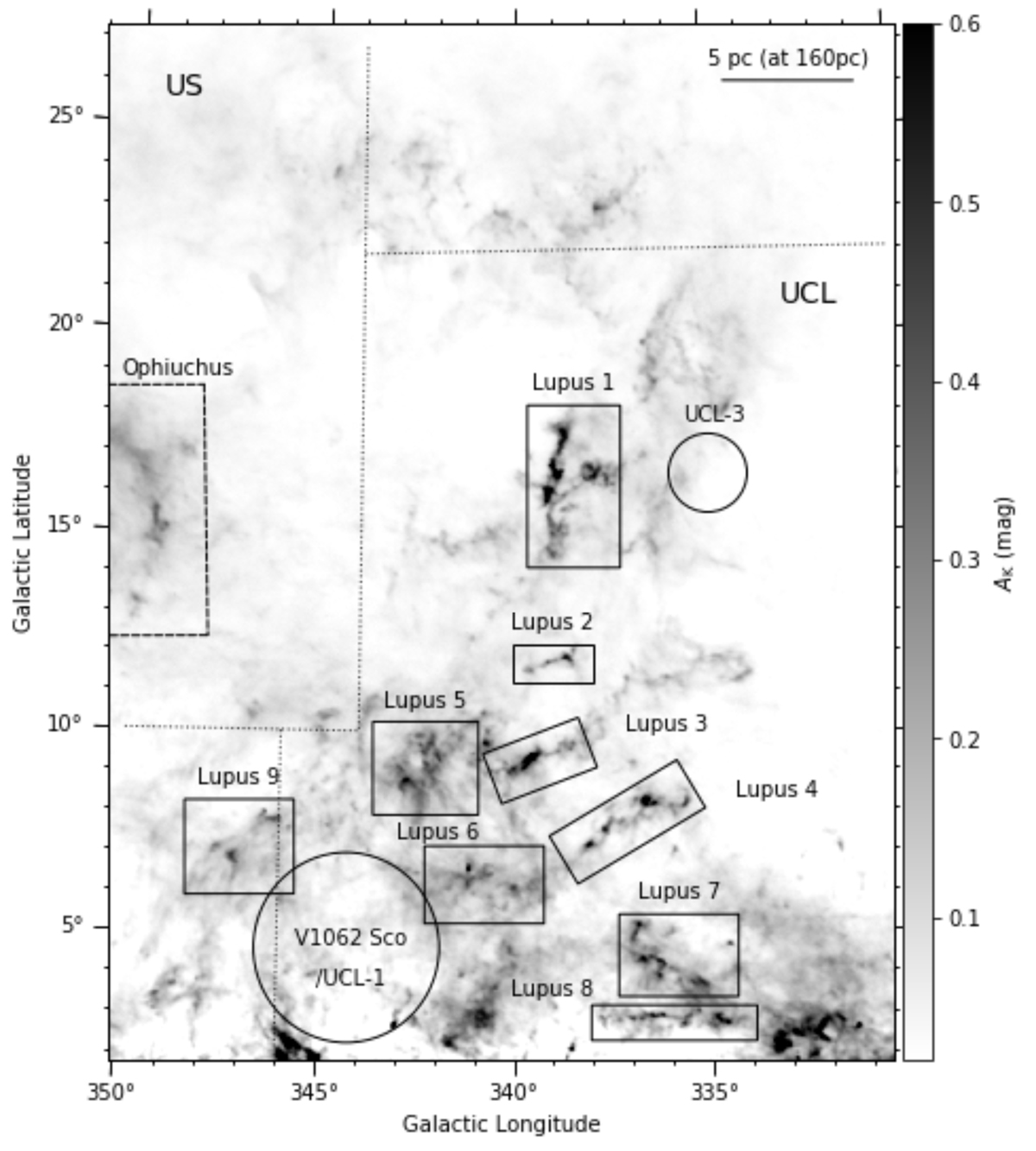
Planck extinction map of the Lupus complex (Planck Collaboration XI 2014), showing the area surveyed in this paper. The eight historically identified Lupus clouds are marked by rectangles. A scale bar of 5 pc (at a distance of 160 pc) is shown for reference. Part of the Ophiuchus cloud is located within the surveyed area, as identified by the dashed rectangle. The dotted lines mark the borders of Upper Scorpius and Upper Centaurus-Lupus subgroups according to de Zeeuw et al. (1999). The circles mark the locations of the compact groups V1062 Sco/UCL-1 and UCL-3 (Röser et al. 2018; Damiani et al. 2019).
Current usage metrics show cumulative count of Article Views (full-text article views including HTML views, PDF and ePub downloads, according to the available data) and Abstracts Views on Vision4Press platform.
Data correspond to usage on the plateform after 2015. The current usage metrics is available 48-96 hours after online publication and is updated daily on week days.
Initial download of the metrics may take a while.