Fig. 12.
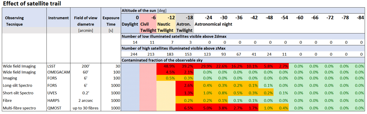
Probability that an exposure is ruined by a satellite trail, expressed as the fraction of the observable sky (down to z = 60°) contaminated by at least one trail during the duration of the exposure, for the considered observing technique. These are listed as a function of the elevation of the sun (in degrees below the horizon). Low- and high-altitude, and bright and faint satellites are evaluated separately and combined in these totals. Various observing techniques are considered, each having a different field of view and typical exposure time. In the case of LSST, because of the heavy saturation of the satellite trails, it is assumed that the whole field of view is entirely ruined by a satellite.
Current usage metrics show cumulative count of Article Views (full-text article views including HTML views, PDF and ePub downloads, according to the available data) and Abstracts Views on Vision4Press platform.
Data correspond to usage on the plateform after 2015. The current usage metrics is available 48-96 hours after online publication and is updated daily on week days.
Initial download of the metrics may take a while.