Fig. 3
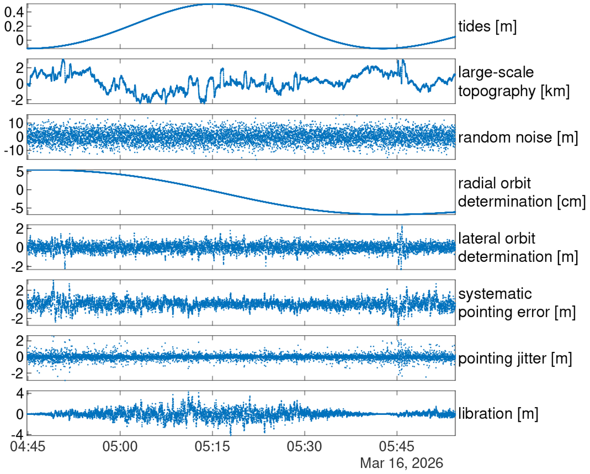
Contributions of each of the simulated signals to range measurements of the altimeter for the time span of one orbit of the MPO, using topography case 1. Libration, pointing, and orbit determination errors contribute to the depicted range measurements mainly through their lateral effect, sampling the topography at a slightly different location. Only measurements with a range < 1050 km are shown. During the depicted time frame, the spacecraft altitude ranges from 1050 km down to 400 km and back to 1050 km. Random noise contains the range error and the Gaussian noise representing small-scale topography. Signals vary for each orbit and each random realization.
Current usage metrics show cumulative count of Article Views (full-text article views including HTML views, PDF and ePub downloads, according to the available data) and Abstracts Views on Vision4Press platform.
Data correspond to usage on the plateform after 2015. The current usage metrics is available 48-96 hours after online publication and is updated daily on week days.
Initial download of the metrics may take a while.