Fig. 2.
Download original image
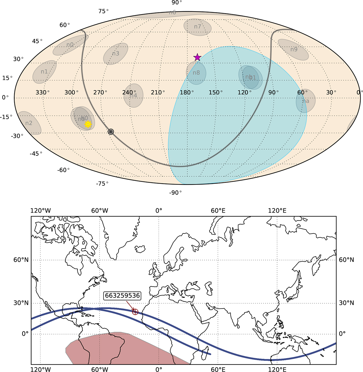
Analysis of the Fermi/GBM field of view for GRB 220107A illustrating the visibility of the GRB position relative to Earth occultation. The upper panel shows a full-sky map in celestial coordinates and the location of GRB 220107A marked by a pink star. The pointing directions of all 14 GBM detectors at the trigger time are indicated by light-gray circles, which represent the detector normal directions and do not correspond to the detectors’ fields of view. The Galactic plane is shown as a thick gray band, with the Galactic center marked by a circle. The Earth, as seen from the Fermi spacecraft in orbit, is shown as a blue polygon, indicating the Earth-occulted region of the sky. The position of the Sun is marked by a yellow smiley symbol. The lower panel shows the geolocation of the Fermi spacecraft at the time of the trigger, marked by a red circle with the mission elapsed time. The red shaded region highlights the South Atlantic Anomaly, while the solid blue line indicates the orbital trajectory of the Fermi spacecraft.
Current usage metrics show cumulative count of Article Views (full-text article views including HTML views, PDF and ePub downloads, according to the available data) and Abstracts Views on Vision4Press platform.
Data correspond to usage on the plateform after 2015. The current usage metrics is available 48-96 hours after online publication and is updated daily on week days.
Initial download of the metrics may take a while.