Fig. 1
Download original image
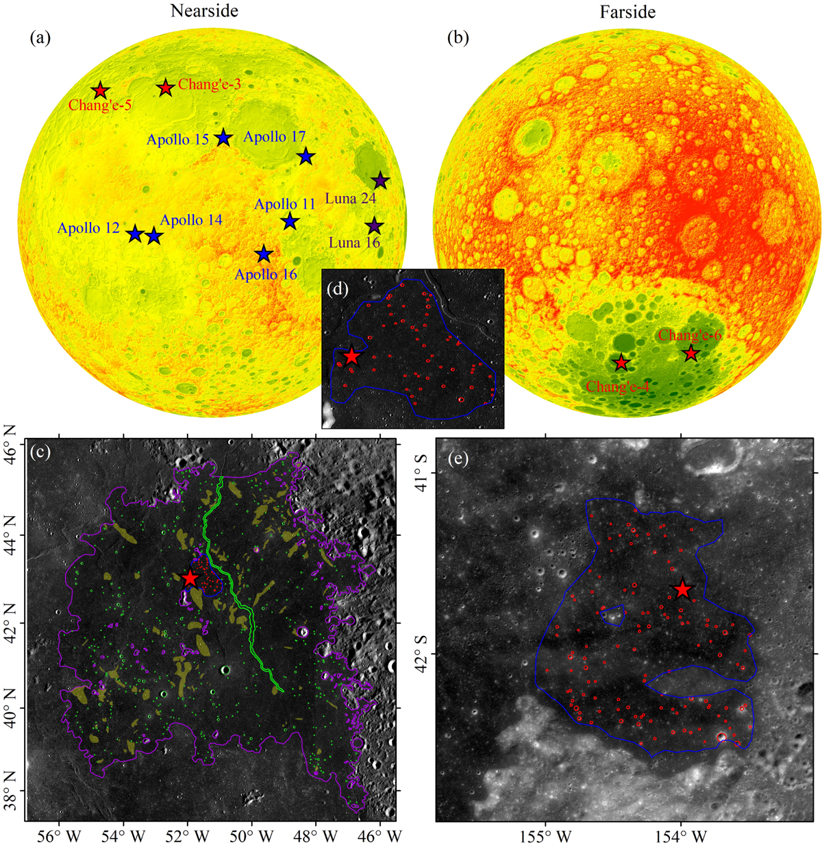
Crater density measurements. (a) Nearside and (b) farside of the Moon. Lunar Orbiter Laser Altimeter elevation data (Smith et al. 2010) were used, and the landing sites of the lunar exploration missions with returned samples (except for the Chang’e-3 and 4 missions) are shown. (c) Mapped craters (green circles) at the mare unit (purple polygon) containing the Chang’e-5 landing site (the star). Obvious secondary crater fields (light yellows) are excluded (Xie & Xiao 2023). (d) Zoomed-in view of the small nested crater mapping area. (e) Mapped craters (red circles) at the mare unit (green polygon) containing the Chang’e-6 landing site (the star) with the exclusion of secondary crater fields. The blue polygon shows the measurement boundary. The base maps of both panels c and e are Kaguya Terrain Camera morning.
Current usage metrics show cumulative count of Article Views (full-text article views including HTML views, PDF and ePub downloads, according to the available data) and Abstracts Views on Vision4Press platform.
Data correspond to usage on the plateform after 2015. The current usage metrics is available 48-96 hours after online publication and is updated daily on week days.
Initial download of the metrics may take a while.