Fig. 2
Download original image
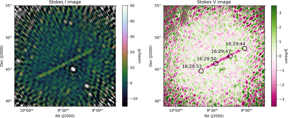
Stokes I and Stokes V images produced with NenuFAR data, illustrating STARLINK-31034 passing through the FoV. The images were created using data collected between 54 and 66 MHz on 6 June 2024, between 16:29:46 and 16:29:57. The black circles overlaid on the Stokes V image represent the predicted positions of the Starlink satellite, calculated using TLE data. The corresponding times for each position are annotated next to the circles. They illustrate the satellite motion.
Current usage metrics show cumulative count of Article Views (full-text article views including HTML views, PDF and ePub downloads, according to the available data) and Abstracts Views on Vision4Press platform.
Data correspond to usage on the plateform after 2015. The current usage metrics is available 48-96 hours after online publication and is updated daily on week days.
Initial download of the metrics may take a while.