Fig. 1
Download original image
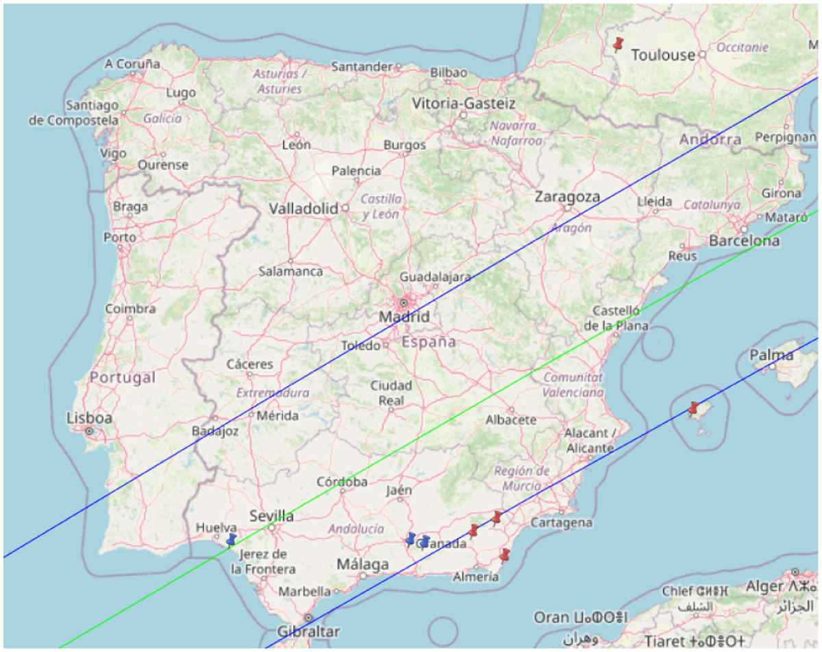
Map of the ground track of our latest prediction update, based on astrometry obtained at the 2 m LT on La Palma. A spherical diameter of D = 285 km was used for 2003 UY117 for the predicted shadow path width (blue lines) plotted in this figure. The map also displays the sites where the occultation was observed, with blue markers indicating a positive detection and red ones indicating a negative detection (i.e., a “miss”). Negative observations reported from Belgium and England, which were located within the uncertainty of the original nominal prediction, are outside this map. Map credit: OpenStreetMap.
Current usage metrics show cumulative count of Article Views (full-text article views including HTML views, PDF and ePub downloads, according to the available data) and Abstracts Views on Vision4Press platform.
Data correspond to usage on the plateform after 2015. The current usage metrics is available 48-96 hours after online publication and is updated daily on week days.
Initial download of the metrics may take a while.