Fig. 5.
Download original image
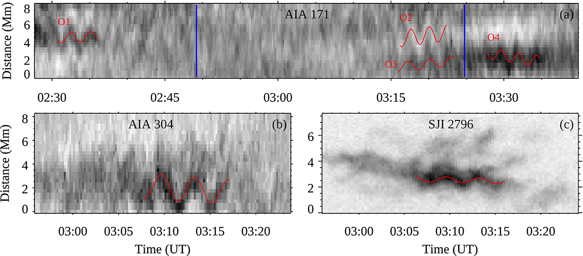
Tracking of the rain blobs along larger loop. Panels a–c depict the location of the curved slit traced along the rain blobs in AIA 304, SJI 2796, and along the loop in AIA 171. Here we aim aim to detect the presence of rain blobs. The placement of the slit is determined based on the trajectory of the rain blobs observed in SJI 2796 images. Panels d–f illustrate the x − t maps associated with the curved slit in AIA 304, SJI 2796, and AIA 171. The black line in the x − t maps represents the estimated position of slit 3 on the curved slit. Around 03:20 UT, the descending rain in EUV absorption is traced by the red dashed line in the AIA 171 x − t map. The line is displayed with an offset to clearly identify the rain features in EUV absorption. The blue dashed line in AIA 304 and SJI 2796 corresponds to the red dashed line in AIA 171.
Current usage metrics show cumulative count of Article Views (full-text article views including HTML views, PDF and ePub downloads, according to the available data) and Abstracts Views on Vision4Press platform.
Data correspond to usage on the plateform after 2015. The current usage metrics is available 48-96 hours after online publication and is updated daily on week days.
Initial download of the metrics may take a while.