Fig. 1.
Download original image
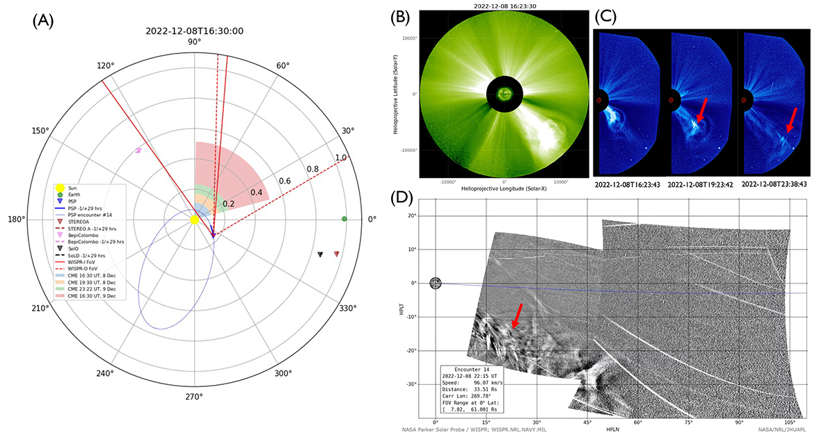
Overview of the December 8, 2022 event showing the spacecraft constellation (panel A), using an HCI coordinate system, together with white-light imaging data (with EUV inserts from SUVI in 304 Å, and EUVI in 195 Å) recorded from the various spacecraft vantage points. Panel B shows the vantage point from STA/COR2, panel C shows the vantage point from SOHO/LASCO/C3 and panel D, shows the vantage point from PSP/WISPR. The red arrows in panels C and D highlight the localized density enhancements, referring to the magnetic fine structures contained in the core of the CME (see Sect. 4.4). The spacecraft constellation shows PSP’s orbit for E14 with the blue dashed line and the PSP trajectory during the event with the blue solid line. The PSP longitude changed ∼24° over the entire duration of the event (15:30 UT on December 8 to 23:30 UT on December 9). The FoV of WISPR-I (red solid line) and WISPR-O (red dashed line) are also shown together with the CME propagation direction and width, which was obtained using the GCS reconstruction results (see Sect. 4.3), at four different instants of time (16:30 UT [0.11 AU], 19:30 UT [0.17 AU], and 23:22 UT [0.23 AU] on December 8 and 16:30 UT [0.51 AU] on December 9).
Current usage metrics show cumulative count of Article Views (full-text article views including HTML views, PDF and ePub downloads, according to the available data) and Abstracts Views on Vision4Press platform.
Data correspond to usage on the plateform after 2015. The current usage metrics is available 48-96 hours after online publication and is updated daily on week days.
Initial download of the metrics may take a while.