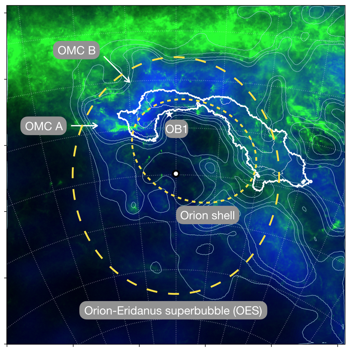
Fig. 2.
Download original image
Stereographic view of the 3D dust map integrated between 300 and 500 pc (in blue) and the total gas column density (NH, in green) toward the Orion-Taurus ridge, shown with white contours. Light-blue contours trace the 3D dust map at AV = 2, 3, 4, 5 mag. The NH map is shown above 1021 cm−2. The coordinate grid and the white contours are the same as in Fig. 1. The long-dashed yellow line indicates the edge of the OES. The short-dashed-yellow line indicates the edge of the Orion shell reported by Foley et al. (2023). A white circle highlights the center of the OES.
Current usage metrics show cumulative count of Article Views (full-text article views including HTML views, PDF and ePub downloads, according to the available data) and Abstracts Views on Vision4Press platform.
Data correspond to usage on the plateform after 2015. The current usage metrics is available 48-96 hours after online publication and is updated daily on week days.
Initial download of the metrics may take a while.