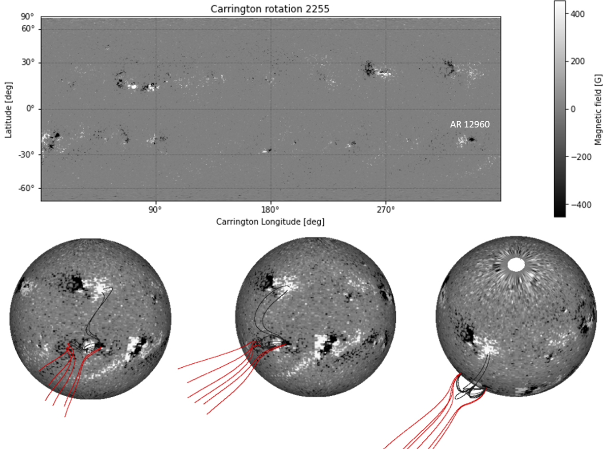
Fig. 11.
Download original image
PFSS model carried out for CR 2255. Top panel: corresponding HMI synoptic map. AR 12960 is located at a longitude of 340° and a latitude of −20°. Lower panels: three different points of view of the PFSS model illustrating the existence of a pseudo-streamer. The right view point corresponds to a solar disc centre located at 330° of longitude and 0° of latitude. The middle view point remains at the same latitude but sets the solar disc centre at a longitude of 360°. The left view point has the solar disc centre at a latitude of 50° and a longitude of 360°. The black lines correspond to closed field lines, and the red lines denote open field lines anchored in negative field polarities. The bar to the right of the top panel indicates the scale of the magnetic field values.
Current usage metrics show cumulative count of Article Views (full-text article views including HTML views, PDF and ePub downloads, according to the available data) and Abstracts Views on Vision4Press platform.
Data correspond to usage on the plateform after 2015. The current usage metrics is available 48-96 hours after online publication and is updated daily on week days.
Initial download of the metrics may take a while.