Fig. 21
Download original image
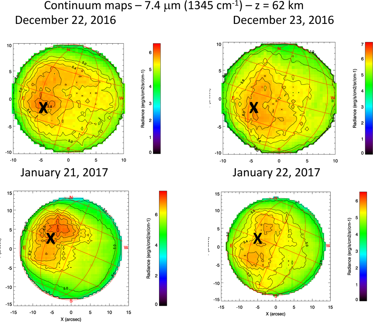
Examples of continuum maps indicating the possible presence of mountain waves. Top: continuum maps recorded at 1345 cm−1, probing the cloud top (62 km), on December 22 (left) and December 23 (right), 2016. On December 22, 2016, the SEP longitude was 157.3 E and the evening terminator longitude was 144.7 E. The black crosses indicate the position of Thetis Regio. Bottom: continuum maps recorded at 1345 cm−1, probing the cloud top (62 km), on January 21 (left) and January 22 (right), 2017. On January 21, 2017, the SEP longitude was 233.1 E and the evening terminator longitude was 237.4 E. The black crosses indicate the position of Atla Regio.
Current usage metrics show cumulative count of Article Views (full-text article views including HTML views, PDF and ePub downloads, according to the available data) and Abstracts Views on Vision4Press platform.
Data correspond to usage on the plateform after 2015. The current usage metrics is available 48-96 hours after online publication and is updated daily on week days.
Initial download of the metrics may take a while.