Fig. 5
Download original image
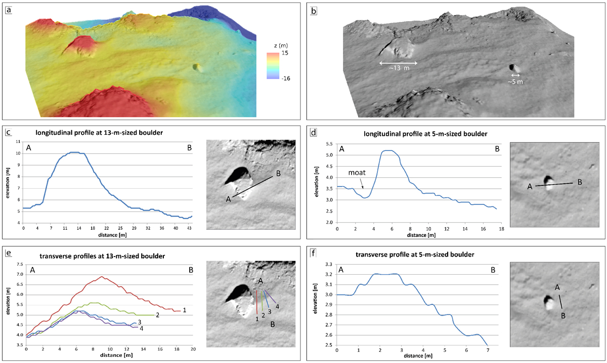
Morphometry of wind tails at the Agilkia landing site. (a and b): perspective views showing the two boulders based on OSIRIS images and DTM data (Jorda et al. 2016). Colors in a encode elevations from – 16 m (blue) to + 15 m (red). Labels in b indicate boulder sizes. The lateral and vertical DTM resolutions are about 35 and 10 cm per pixel, respectively. (c–f): longitudinal and transverse cross sections of the wind tails (and the moat) associated with the two boulders at Agilkia (Tirsch et al. 2017a). The size of the wind tail in profile (ƒ) is at the limit of the DTM resolution which is the reason for the step-like shape of the profile.
Current usage metrics show cumulative count of Article Views (full-text article views including HTML views, PDF and ePub downloads, according to the available data) and Abstracts Views on Vision4Press platform.
Data correspond to usage on the plateform after 2015. The current usage metrics is available 48-96 hours after online publication and is updated daily on week days.
Initial download of the metrics may take a while.