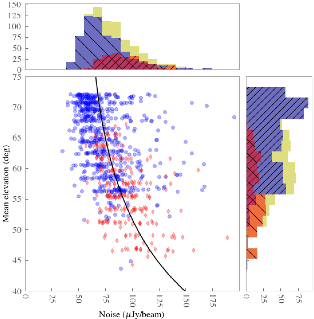
Fig. 15.
Download original image
Sensitivity of each individual pointing that makes up LoTSS-DR2 as a function of the mean elevation during the observation. The sensitivities are scaled to their equivalent for an 8 h run by taking into account the exact integration time and the fraction of data that are flagged. The blue points and blue histograms with \ hatchings show pointings in the RA-13 region and the red points and red histograms with / hatchings show the pointings in the lower average declination RA-1 region. The yellow histograms correspond to all pointings in both regions. The black line shows the best fit A×cos(90-elevation)−2.0 curve where A is found to be 62 μJy beam−1 and the dependence on elevation is fixed according to the projected size of the LOFAR stations.
Current usage metrics show cumulative count of Article Views (full-text article views including HTML views, PDF and ePub downloads, according to the available data) and Abstracts Views on Vision4Press platform.
Data correspond to usage on the plateform after 2015. The current usage metrics is available 48-96 hours after online publication and is updated daily on week days.
Initial download of the metrics may take a while.