Fig. 9.
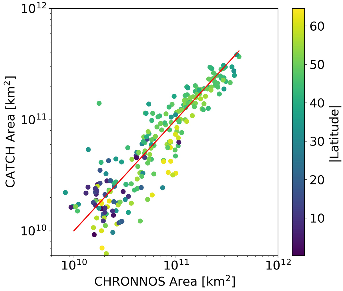
Comparison of the coronal hole areas as derived by CHRONNOS and the manual CATCH labels. Each data point corresponds to an individual coronal hole, where the latitude of the center of mass of the coronal hole is indicated by the color coding. The red line indicates the ideal one-to-one correspondence. The areas are plotted on a double logarithmic scale. The largest deviations occur for small and high-latitudinal coronal holes.
Current usage metrics show cumulative count of Article Views (full-text article views including HTML views, PDF and ePub downloads, according to the available data) and Abstracts Views on Vision4Press platform.
Data correspond to usage on the plateform after 2015. The current usage metrics is available 48-96 hours after online publication and is updated daily on week days.
Initial download of the metrics may take a while.