Fig. 8
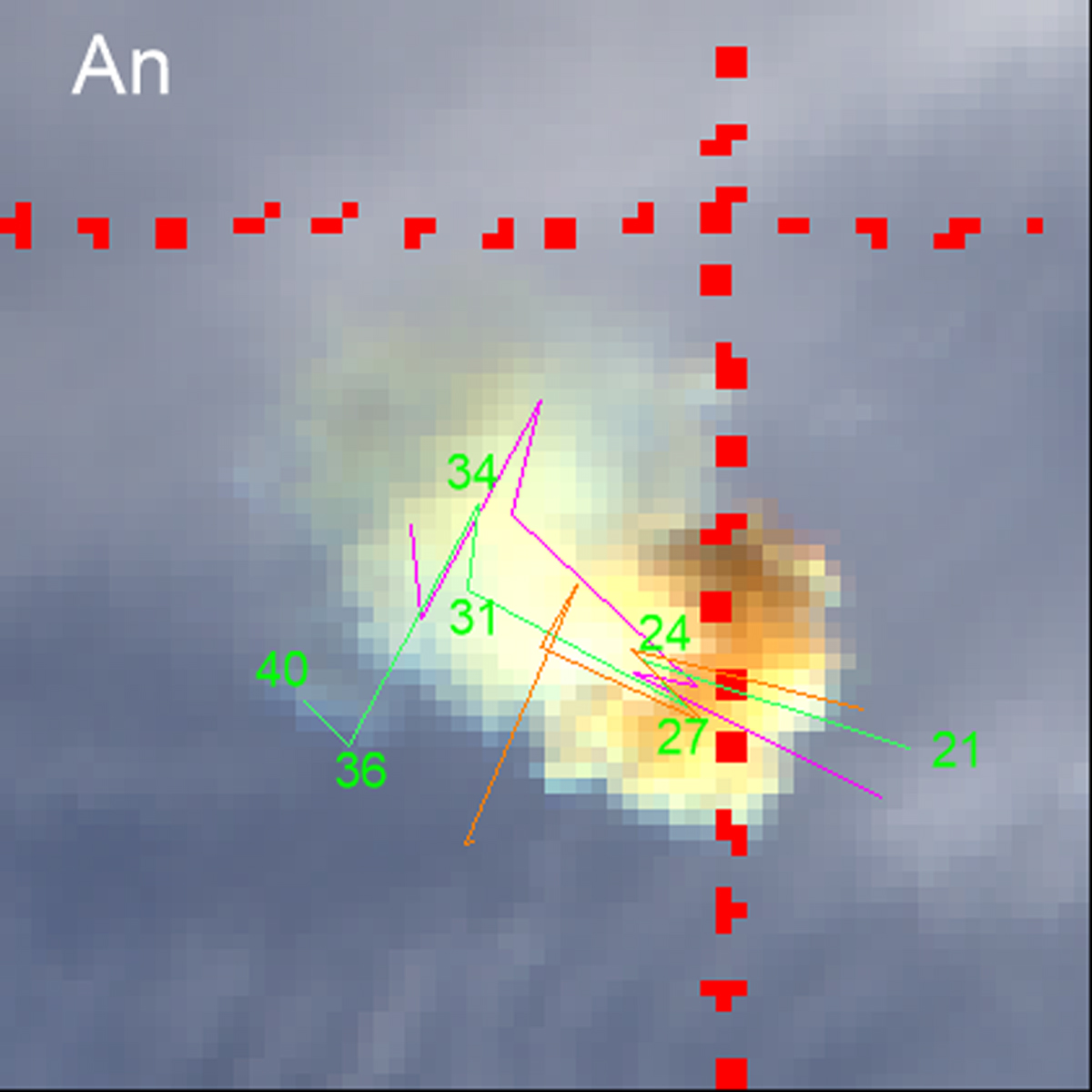
Enlarged and rotated image of the trail from MISR camera An. Red dots are part of the coordinate grid (meridian 172.5°, parallel 57°). The magenta line shows the modeled trail projection assuming the USGS bolide radiant, the green line with height indications is for the nominal radiant, and the orange line is for vertical trajectory.
Current usage metrics show cumulative count of Article Views (full-text article views including HTML views, PDF and ePub downloads, according to the available data) and Abstracts Views on Vision4Press platform.
Data correspond to usage on the plateform after 2015. The current usage metrics is available 48-96 hours after online publication and is updated daily on week days.
Initial download of the metrics may take a while.