Fig. 7
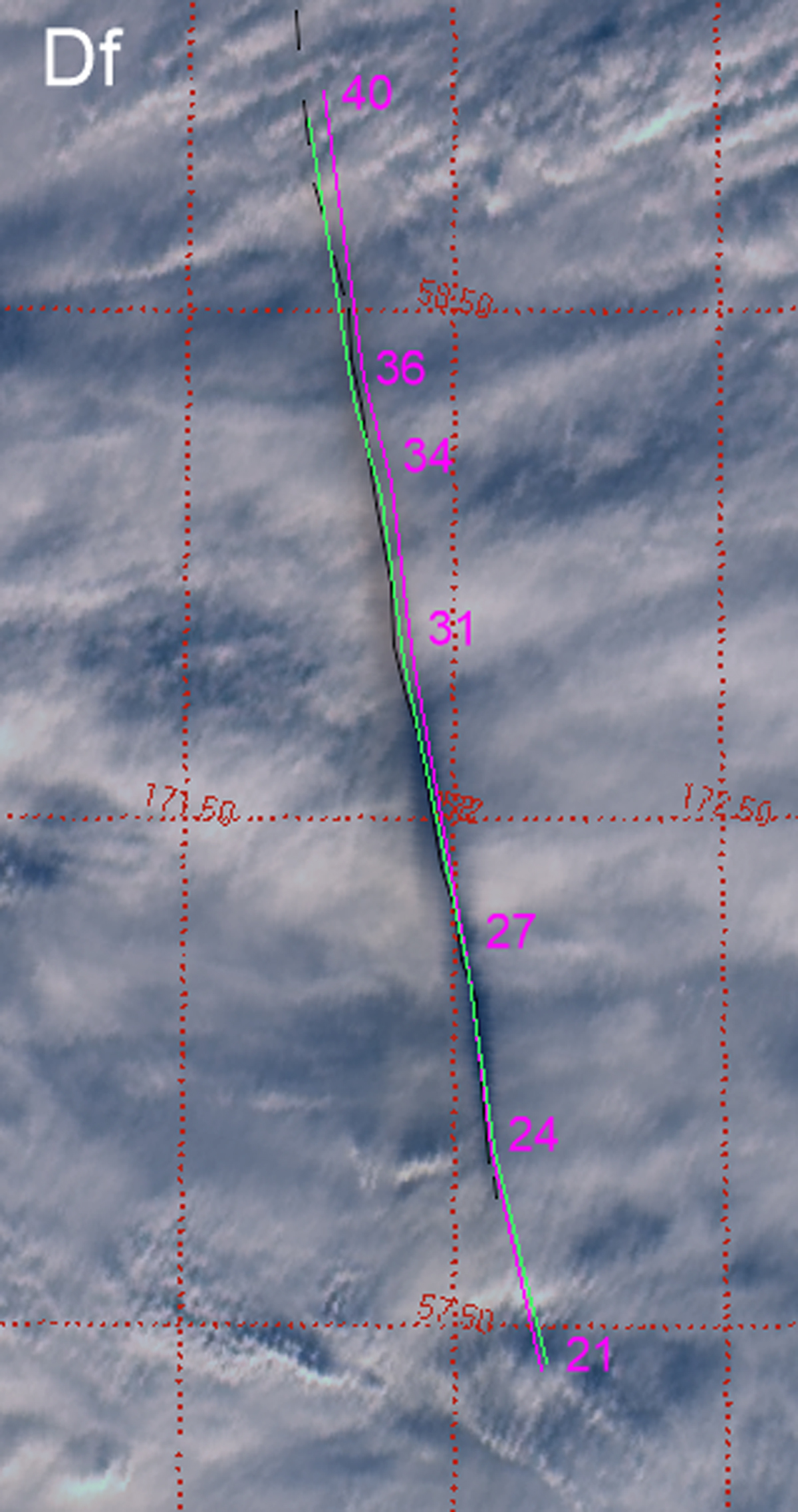
Image of the trail shadow from MISR camera Df, rotated and with the coordinate grid added. The center of the shadow was marked manually with a black line. The dashed line was used for indistinct parts of the shadow. The magenta line shows the modeled shadow assuming the USGS bolide radiant. The numbers are the corresponding trail heights (rounded heights for the pressure levels, where wind data are available; see Table 1). The green line shows the modeled shadow assuming the nominal radiant determined by us.
Current usage metrics show cumulative count of Article Views (full-text article views including HTML views, PDF and ePub downloads, according to the available data) and Abstracts Views on Vision4Press platform.
Data correspond to usage on the plateform after 2015. The current usage metrics is available 48-96 hours after online publication and is updated daily on week days.
Initial download of the metrics may take a while.