Fig. B.1
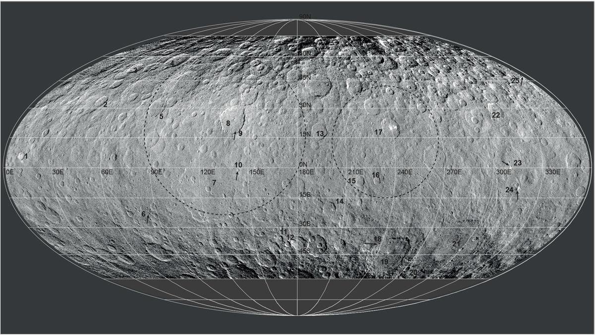
Framing Camera LAMO map from Roatsch et al. (2016b) reprocessed as a HiPS and with a Mollweide projection. The map is used as background context for the maps of the spectral slopes in Figs. 5–7, as well as for the maps of Sect. 4. The dashed ellipse on the left correspond broadly to Vendimia Planitia, to the right of Hanami Planum. The main numbered features are: (1) Haulani; (2) Ikapati; (3) Ernutet; (4) Omonga; (5) Gaue; (6) Braciaca; (7) Kerwan; (8) Dantu; (9) Centeotl; (10) Cacaguat; (11) Juling; (12) Kupalo; (13) Nawish; (14) Consus; (15) Azacca; (16) Lociyo; (17) Occator; (18) Tawals; (19) Urvara; (20) Nunghui; (21) Yalode; (22)Fejokoo; (23) Xevioso; (24) Ahuna Mons; and (25) Oxo.
Current usage metrics show cumulative count of Article Views (full-text article views including HTML views, PDF and ePub downloads, according to the available data) and Abstracts Views on Vision4Press platform.
Data correspond to usage on the plateform after 2015. The current usage metrics is available 48-96 hours after online publication and is updated daily on week days.
Initial download of the metrics may take a while.