Fig. 3
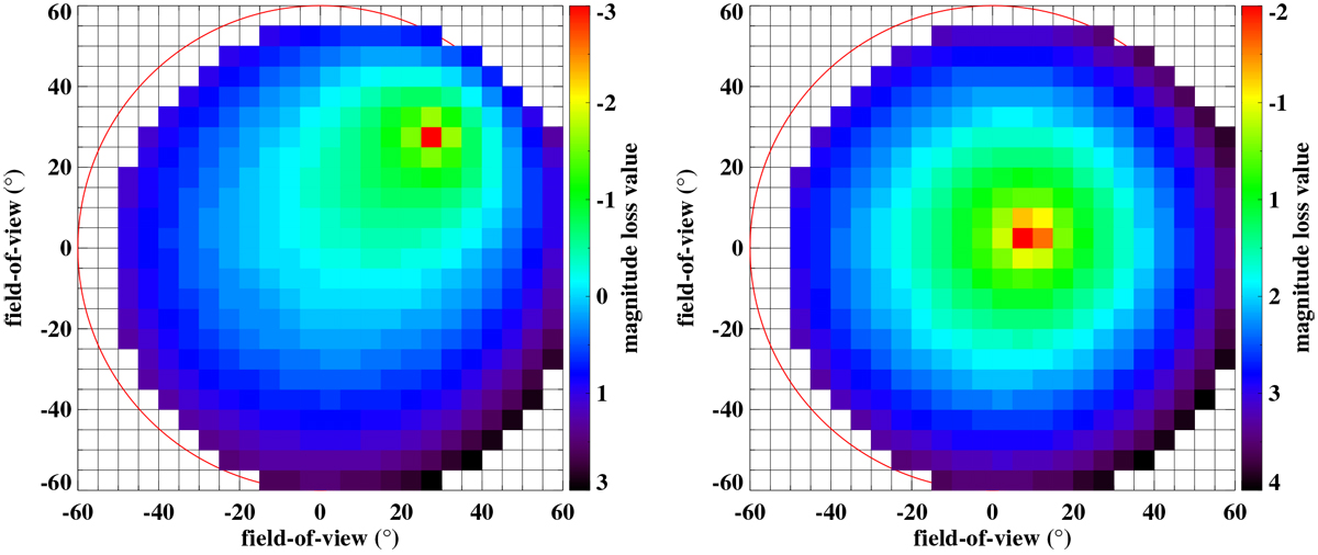
Corrections computed using the magnitude loss function for the field-of-view of the camera. Each square has an angular distance of five degrees. The coloured squares represent the overlapping area of the two stations at a height of 100 km, assuming a circular field-of-view of 60° radius. The colours represent the amount of loss in magnitude. Areas with cold colours represent parts of the field-of-view where meteors will appear fainter, while meteors appearing in hot-coloured squares will appear brighter. Meteors located in the red squares will appear as point-like sources since this area indicates the apparent position of the radiant. Left figure: radiant is located at azimuth = 45°, altitude = 50°. Right figure: at azimuth = 70°, altitude = 80° with respectto the camera viewing direction.
Current usage metrics show cumulative count of Article Views (full-text article views including HTML views, PDF and ePub downloads, according to the available data) and Abstracts Views on Vision4Press platform.
Data correspond to usage on the plateform after 2015. The current usage metrics is available 48-96 hours after online publication and is updated daily on week days.
Initial download of the metrics may take a while.