Fig. 14
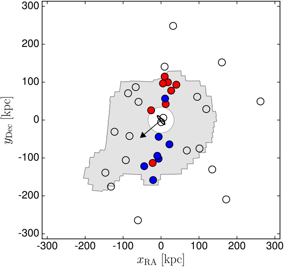
Satellites of M 31 (circles). The blue and red satellites belong to the GPoA. The satellites in blue are approaching Earth from the coordinate system connected with M 31, the satellites in red are receding. The arrow indicates the spin of the M 31 galactic disk. Compare to the model shown in Fig. 13. The area covered by the PAndAS survey is shown in gray to facilitate the comparison with the image of the galaxy in Fig. 15. Image courtesy Marcel Pawlowski (adapted from Fig. 11 in Bullock & Boylan-Kolchin 2017).
Current usage metrics show cumulative count of Article Views (full-text article views including HTML views, PDF and ePub downloads, according to the available data) and Abstracts Views on Vision4Press platform.
Data correspond to usage on the plateform after 2015. The current usage metrics is available 48-96 hours after online publication and is updated daily on week days.
Initial download of the metrics may take a while.