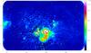
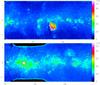
Fig. 7
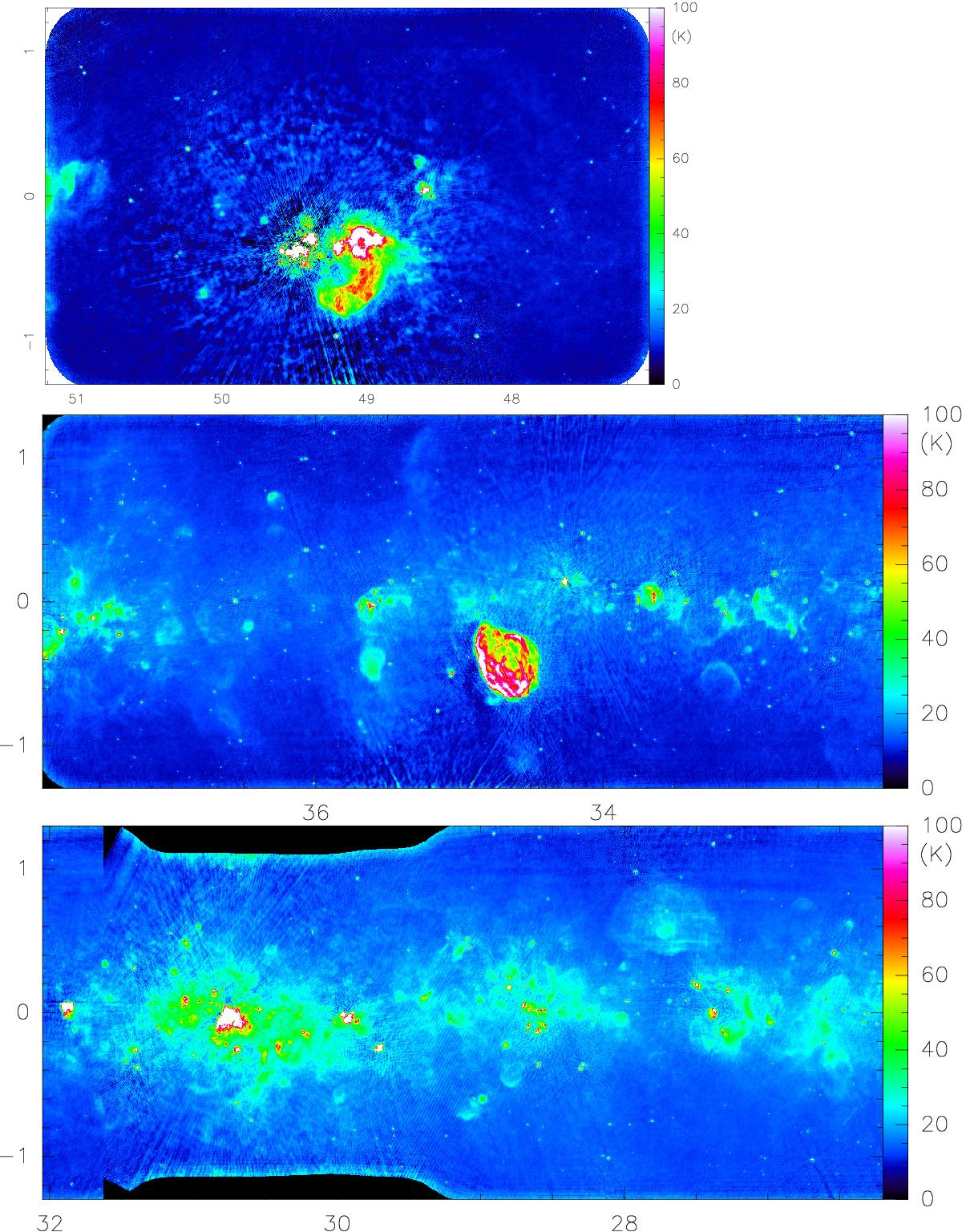
THOR continuum data at 1.4 GHz in degrees of Galactic longitude and latitude. The images are constructed by combining the THOR C-configuration data with the VGPS data that were produced from the VLA D-configuration with the GBT. The angular resolution of this image is 20′′. The conversion from Jy beam-1 to K is made in the Rayleigh-Jeans limit. Top panel: region around W51 at the Sagittarius tangent point. Bottom two panels: areas between longitudes 37.9 and 26.2 degrees. The color scale is chosen to simultaneously show as much large- and small-scale emission as possible. The slightly different sky coverage in latitude around 31 degrees longitude is taken from the pilot study.
Current usage metrics show cumulative count of Article Views (full-text article views including HTML views, PDF and ePub downloads, according to the available data) and Abstracts Views on Vision4Press platform.
Data correspond to usage on the plateform after 2015. The current usage metrics is available 48-96 hours after online publication and is updated daily on week days.
Initial download of the metrics may take a while.