Fig. 5
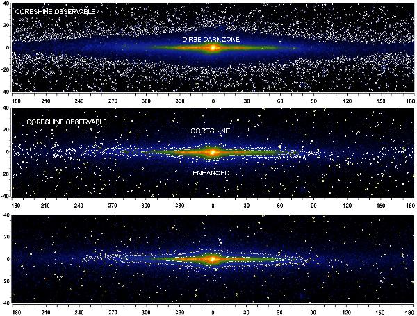
Color-coded is the DIRBE all-sky map between latitudes of −40° and +40° at 3.5 μm which serves as background after subtracting the stellar contamination. Overlaid are contours of the scattering-extinction balance for MRN(0.5) (top), for MRN(1) taking into account phase function effects and treating extinction in 1st-order Taylor approximation (middle), and for MRN(1) and 2nd-order Taylor approximation (bottom), respectively.
Current usage metrics show cumulative count of Article Views (full-text article views including HTML views, PDF and ePub downloads, according to the available data) and Abstracts Views on Vision4Press platform.
Data correspond to usage on the plateform after 2015. The current usage metrics is available 48-96 hours after online publication and is updated daily on week days.
Initial download of the metrics may take a while.