Fig. 6
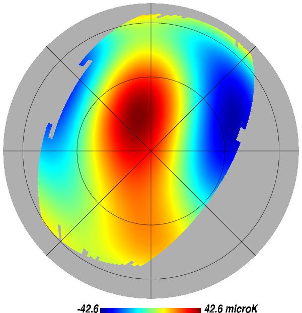
Orthographic projection of the ℓ = 2 to 6 multipoles map extracted from the foreground reduced WMAP Q map, in galactic coordinates. Only half of the map is visible (centred on the galactic north pole), with a mask showing only the area covered by the main SDSS. A graticule grid has been superposed with a 45° step in longitude and 30° in latitude.
Current usage metrics show cumulative count of Article Views (full-text article views including HTML views, PDF and ePub downloads, according to the available data) and Abstracts Views on Vision4Press platform.
Data correspond to usage on the plateform after 2015. The current usage metrics is available 48-96 hours after online publication and is updated daily on week days.
Initial download of the metrics may take a while.