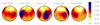
Fig. 20
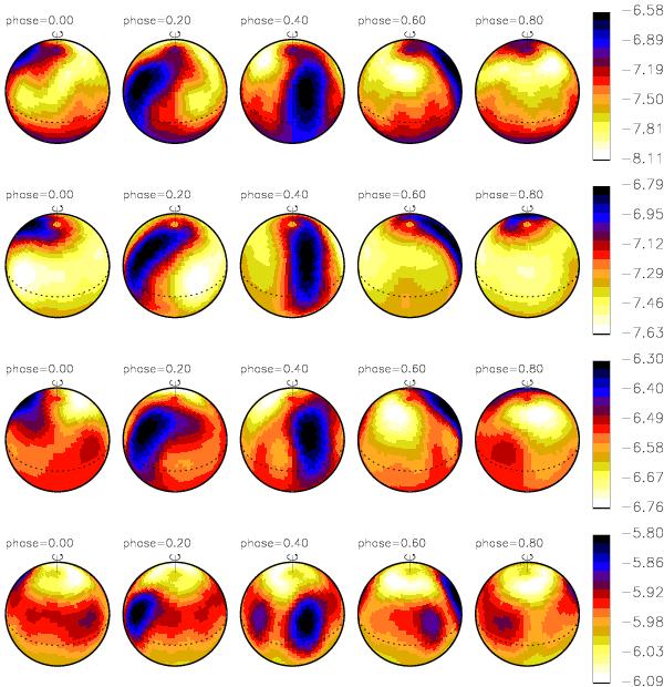
Doppler maps of HD 11753 from January 2010 data obtained with HARPSpol. The maps are from top to bottom: Y ii, Sr ii, Ti ii and Cr ii. These same data have been used for Doppler imaging by Makaganiuk et al. (2012). Here, same lines and inclination angle as for the CORALIE datasets have been used, but now the ephemeris is from Makaganiuk et al. (2012) to enable an easy comparison. The results are presented from the same phases as used by Makaganiuk et al. (2012), and are virtually identical to theirs.
Current usage metrics show cumulative count of Article Views (full-text article views including HTML views, PDF and ePub downloads, according to the available data) and Abstracts Views on Vision4Press platform.
Data correspond to usage on the plateform after 2015. The current usage metrics is available 48-96 hours after online publication and is updated daily on week days.
Initial download of the metrics may take a while.