Fig. 1
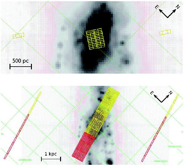
Spitzer-MIPS 24 μm map (Varoujian Gorjian, priv. comm.) of the central region of NGC 4945. The galaxy major axis runs vertical. North is toward the upper right, east toward the upper left. Along the declination axis, the grid spacing is ~1 arcmin, and about 12 s along the RA axis. The region mapped with the IRS-SH module (top panel) is about 21′′ × 26′′, while a larger region of 37′′ × 67′′ was mapped with the IRS-SL (bottom panel) module. The red and yellow grids correspond to the SL1 and SL2 spectral orders, respectively. The sky (off-source) positions observations are indicated by the grids to the left and right of the galaxy major axis. The images were produced with the Spitzer/Leopard software package used to query the archive and download the data.
Current usage metrics show cumulative count of Article Views (full-text article views including HTML views, PDF and ePub downloads, according to the available data) and Abstracts Views on Vision4Press platform.
Data correspond to usage on the plateform after 2015. The current usage metrics is available 48-96 hours after online publication and is updated daily on week days.
Initial download of the metrics may take a while.