Fig. 3
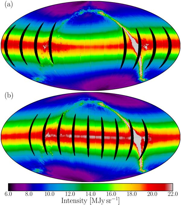
All-sky 9 μm brightness maps for the leading a) and trailing b) directions. The map is drawn in the Mollweide projection in the ecliptic coordinate system. The color is matched with brightness in unit of MJysr-1 along the bottom bar. The map center corresponds to the sky position (0,0) in ecliptic coordinates. The grids are drawn along the meridians at longitudes 240°, 300°, 0, 60°, and 120° from right to left, and the parallels at latitudes −60°, −30°, 0, 30°, and 60° from bottom to top. The regions contaminated by the Moon light are marked in black and were excluded from the analysis.
Current usage metrics show cumulative count of Article Views (full-text article views including HTML views, PDF and ePub downloads, according to the available data) and Abstracts Views on Vision4Press platform.
Data correspond to usage on the plateform after 2015. The current usage metrics is available 48-96 hours after online publication and is updated daily on week days.
Initial download of the metrics may take a while.