Fig. 10
Download original image
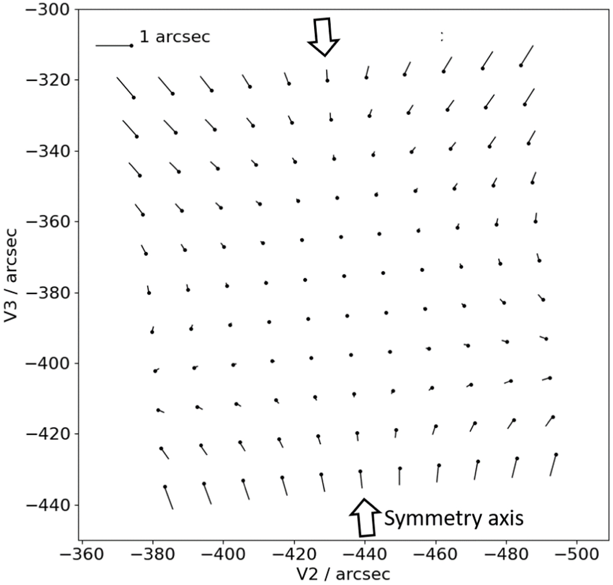
Pre-flight predicted distortion map based on the MIRI optical design. The points are projected from the an equispaced grid at the detector, with corners at pixels (10, 10) and (1013, 1013). The vectors then plot the offset from the on sky positions obtained using the affine components of the distortion transforms, to the positions obtained using the full transforms.
Current usage metrics show cumulative count of Article Views (full-text article views including HTML views, PDF and ePub downloads, according to the available data) and Abstracts Views on Vision4Press platform.
Data correspond to usage on the plateform after 2015. The current usage metrics is available 48-96 hours after online publication and is updated daily on week days.
Initial download of the metrics may take a while.