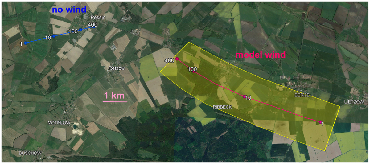
Fig. 9
Download original image
Map of the computed meteorite fall locations for the hypothetical case of no atmospheric wind (blue) and using the ALADIN wind model (red). The numbers show the meteorite masses in grams and are valid for spherical meteorite shapes. The estimated uncertainty area is shown in yellow for the wind case. The 400 g point lies at 52.°6285 N, 12.°7200 E. The background map is from Google Earth. North is up.
Current usage metrics show cumulative count of Article Views (full-text article views including HTML views, PDF and ePub downloads, according to the available data) and Abstracts Views on Vision4Press platform.
Data correspond to usage on the plateform after 2015. The current usage metrics is available 48-96 hours after online publication and is updated daily on week days.
Initial download of the metrics may take a while.