Fig. 8
Download original image
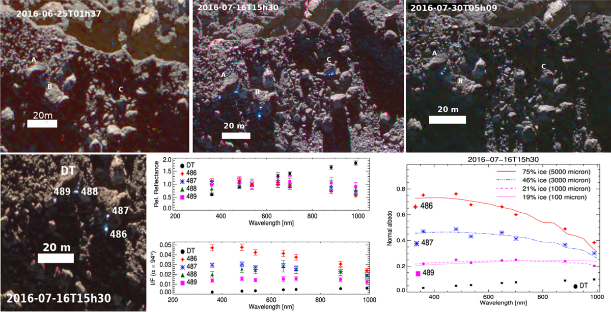
Duration, spectrophotometry and compositional modeling of some blue bright spots in the Anhur region. Top: RGB images showing the blue BS observed in boulders named A, B, and C on 16 July 2016 (top central panel). This area is located close to the canyon-like structure of Anhur (Fornasier et al. 2017). Frosts and tiny blue spots were already present on 25 July 2016 images (top left panel) near the boulders named A and C, and a few close to boulder A were still visible in the 30 July 2016 images (top right panel). Bottom: relative reflectance and I/F of four selected blue BS located in the aforementioned A and B boulders: BS 486 (red star, slope = −8.0%/(100nm)), BS 487 (blue asterisk, slope = −4.3%/(100nm)), BS 488 (green triangle, slope = −1.8%/(100 nm)), and BS 489 (magenta square, slope = 4.6%/(100nm)) in Table A.1. DT indicates the cometary dark terrain. Bottom right: linear mixing models of the cometary dark terrain and water ice with different grain sizes reproducing the spectral behavior of the blue bright features. The estimated water ice abundance is indicated for the different models.
Current usage metrics show cumulative count of Article Views (full-text article views including HTML views, PDF and ePub downloads, according to the available data) and Abstracts Views on Vision4Press platform.
Data correspond to usage on the plateform after 2015. The current usage metrics is available 48-96 hours after online publication and is updated daily on week days.
Initial download of the metrics may take a while.