Fig. 11

Download original image
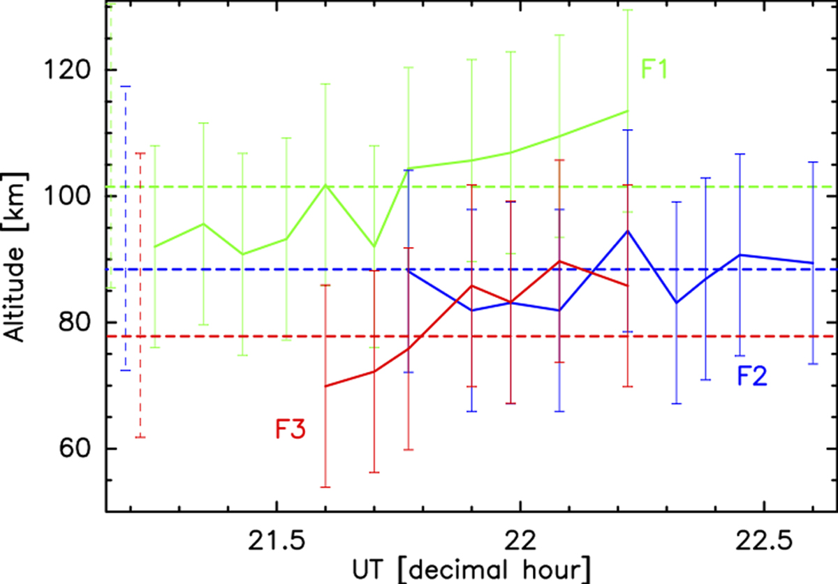
Altitude determination with method 4: results of the altitude determination using the method described in Sect. 3.1.4. The abscissa is the decimal hour. The three features followed here are the same as in Sect. 3.1.3. The solid lines represent the estimated altitudes of the features (green: F1, blue: F2, red: F3) over time after emergence. The error bars are ±16 km. The dashed lines represent the estimated altitude at emergence. Their error bars are ![]() km. They are shown at the beginning of this figure for the sake of clarity. In decimal hours, the exact times of emergence are to(F1) = 10.16, to(F2) = to(F3) = 10.67, i.e. outside the abscissa range.
km. They are shown at the beginning of this figure for the sake of clarity. In decimal hours, the exact times of emergence are to(F1) = 10.16, to(F2) = to(F3) = 10.67, i.e. outside the abscissa range.
Current usage metrics show cumulative count of Article Views (full-text article views including HTML views, PDF and ePub downloads, according to the available data) and Abstracts Views on Vision4Press platform.
Data correspond to usage on the plateform after 2015. The current usage metrics is available 48-96 hours after online publication and is updated daily on week days.
Initial download of the metrics may take a while.


