Fig. 4.
Download original image
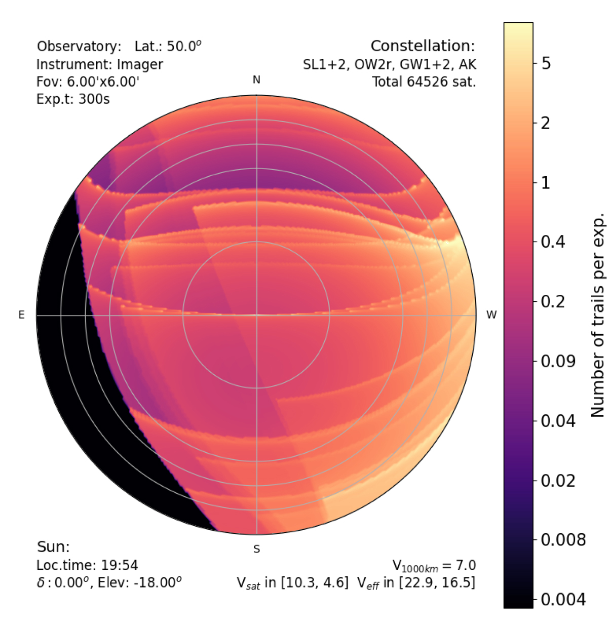
Sky maps with an example of the resulting number of trails per exposures. The circles mark 0°, 10°, 20°, 30°, and 60° elevation. The observatory is located at +50° latitude; the sun at −18° elevation; the camera has a FOV with diameter Lfov = 6′ and the exposure time is 300 s. The satellites are those from Table 1. In the black region at the south-east, all satellites are already in the shadow of the Earth. The edges running from north-east to south-west correspond to constellation shells at lower altitudes, whose south-east parts are already in the shadow. The sharp features running from east to west correspond to the edges of constellation shells whose inclinations are close to the observatory latitude.
Current usage metrics show cumulative count of Article Views (full-text article views including HTML views, PDF and ePub downloads, according to the available data) and Abstracts Views on Vision4Press platform.
Data correspond to usage on the plateform after 2015. The current usage metrics is available 48-96 hours after online publication and is updated daily on week days.
Initial download of the metrics may take a while.