Fig. 10.
Download original image
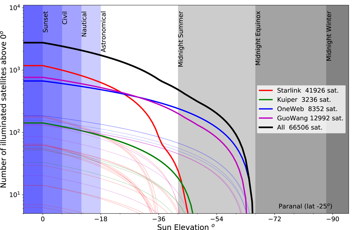
Number of illuminated satellites above the horizon as a function of the Sun elevation, for the constellations listed in Table 1 seen from Paranal (latitude ![]() ; the dependency with latitude is not strong). The twilights are indicated with blue shadings and the elevation of the sun at midnight by grey shadings for the solstices and equinoxes. The thin dotted lines represent the individual shells and the thick lines the totals for each constellation. The upper thick black line is the grand total. This figure illustrates the importance of the altitude of a constellation: the high-altitude satellites (OneWeb, Kuiper) are visible much longer into the night than lower altitude ones. Also, for most of the night, the much smaller OneWeb constellation contributes to more satellites in the sky than the largest one.
; the dependency with latitude is not strong). The twilights are indicated with blue shadings and the elevation of the sun at midnight by grey shadings for the solstices and equinoxes. The thin dotted lines represent the individual shells and the thick lines the totals for each constellation. The upper thick black line is the grand total. This figure illustrates the importance of the altitude of a constellation: the high-altitude satellites (OneWeb, Kuiper) are visible much longer into the night than lower altitude ones. Also, for most of the night, the much smaller OneWeb constellation contributes to more satellites in the sky than the largest one.
Current usage metrics show cumulative count of Article Views (full-text article views including HTML views, PDF and ePub downloads, according to the available data) and Abstracts Views on Vision4Press platform.
Data correspond to usage on the plateform after 2015. The current usage metrics is available 48-96 hours after online publication and is updated daily on week days.
Initial download of the metrics may take a while.