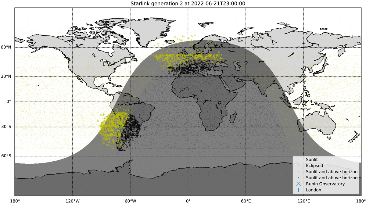
Fig. 1.

Download original image
Discrete realisation of the Starlink Generation 2 constellation overlaid on a map of Earth. The day and night sides of Earth are shown for 2022 June 21 at 23:00UTC, near the June solstice. Satellites are shown as either sunlit (yellow), or eclipsed by the Earth (black) and above the horizon for two geographical locations, Vera Rubin Observatory in Chile (latitude −30°) and London in the United Kingdom (latitude ∼50°). Over-densities of satellites in geographic latitude b are visible at latitudes |b| = 30°, 40° and 53°, corresponding to the inclination of the most populous orbital shells. Due to their orbital altitudes, satellites remain visible for locations where the Sun is below the horizon and will remain visible throughout all the night for locations at high geographical latitudes.
Current usage metrics show cumulative count of Article Views (full-text article views including HTML views, PDF and ePub downloads, according to the available data) and Abstracts Views on Vision4Press platform.
Data correspond to usage on the plateform after 2015. The current usage metrics is available 48-96 hours after online publication and is updated daily on week days.
Initial download of the metrics may take a while.


